Map of Carol Stream, Illinois
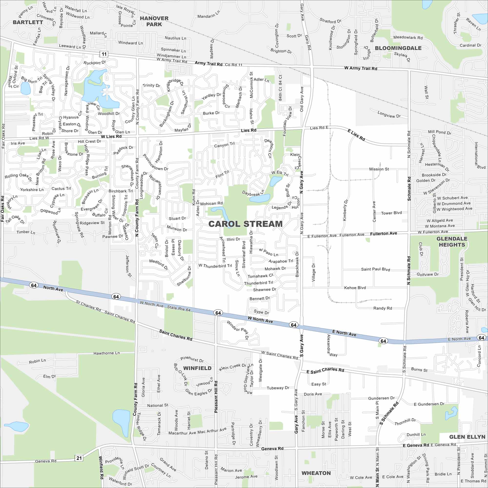
Carol Stream is a western suburb of Chicago. Our map highlights its roads, parks, and small lakes. It’s not directly on a major interstate, but still well-connected regionally.
Illinois State Maps
Get to know Illinois with our state maps


Map Information
On the Map
Interstates/Highways: State Rte 21, State Rte 64 Major Roads: North Ave, Army Trail Rd, Gary Ave, Schick Rd, Lies Rd, Kuhn Rd, County Farm Rd, Fullerton Ave, Saint Charles Rd, Geneva Rd, Main St, Schmale Rd, President St, Glen Ellyn Rd, Morton Rd, Pleasant Hill Rd, Western Ave, Ethel Ave, Thunderbird Trl, Illini Dr Nearby Communities: Bartlett, Hanover Park, Bloomingdale, Winfield, Glendale Heights, Glen Ellyn, WheatonIllinois City Maps
Explore Chicago and urban regions of Illinois


