Map of Cape Girardeau, Missouri
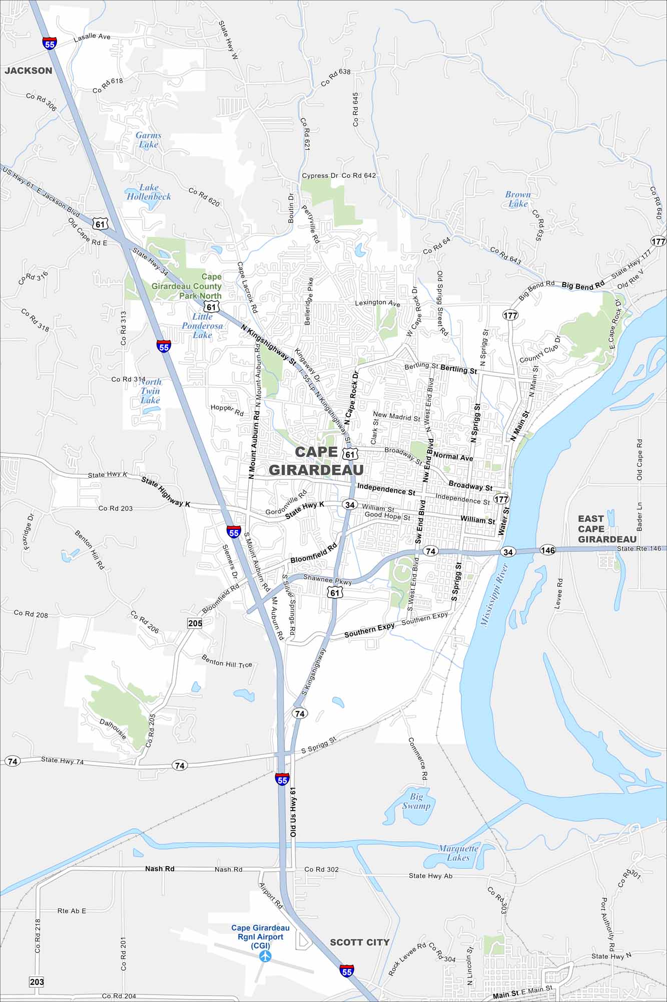
Our map of Cape Girardeau shows this city along the Mississippi River in southeast Missouri. Streets climb up from the river into rolling hills. The riverfront is its heart.
Map Information
On the Map
Interstates/Highways: I-55, US Hwy 61, State Rte 74, State Rte 177, State Rte 34, State Rte 146, Kings Highway Major Roads: William St, Broadway St, Independence St, Sprigg St, Bloomfield Rd, Main St, Mount Auburn Rd, Southern Expy, Shawnee Pkwy, Bertling St, Cape Rock Dr, Lexington Ave, Perryville Rd, Nash Rd, Siemers Dr, Silver Springs Rd, West End Blvd, Spanish St, Water St Airports: Cape Girardeau Rgnl Airport (CGI) Lakes and Reservoirs: Little Ponderosa Lake, North Twin Lake, South Twin Lake, Lake Hollenbeck, Garms Lake, Brown Lake, Big Swamp, Marquette Lakes Major Rivers: Mississippi River Parks and Preserves: Cape Girardeau County Park North Nearby Communities: Jackson, East Cape Girardeau, Scott CityMissouri State Maps
Check out state maps of the Show-Me State.


Missouri City Maps
Here are our city maps for Missouri


