Map of Buffalo Grove, Illinois
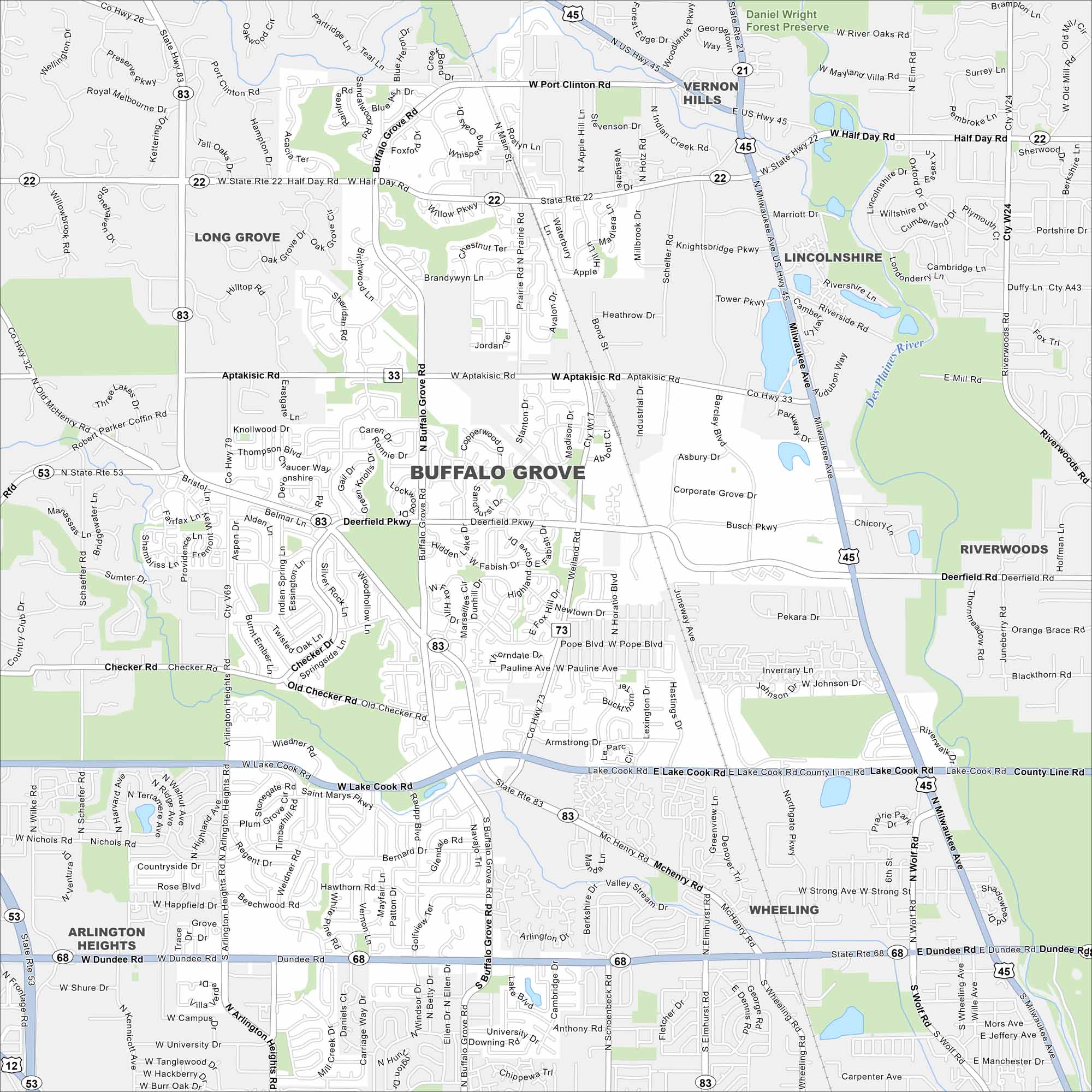
Explore Buffalo Grove with our map, containing roads, parks and lakes. It lies northwest of Chicago. The Des Plaines River is nearby, but much of the city is suburban neighborhoods.
Illinois State Maps
Get to know Illinois with our state maps


Map Information
On the Map
Interstates/Highways: US Hwy 45, State Rte 21, State Rte 22, State Rte 33, State Rte 53, State Rte 68, State Rte 83 Major Roads: Milwaukee Ave, Lake Cook Rd, Dundee Rd, Arlington Heights Rd, McHenry Rd, Aptakisic Rd, Buffalo Grove Rd, Deerfield Pkwy, Busch Pkwy, Half Day Rd, Port Clinton Rd, Checker Rd, Weiland Rd, Thompson Blvd, Brandywyn Ln, Prairie Rd, Main St, Barclay Blvd, Old Checker Rd, Bernard Dr Major Rivers: Des Plaines River Parks and Preserves: Daniel Wright Forest Preserve Nearby Communities: Vernon Hills, Lincolnshire, Riverwoods, Long Grove, Arlington Heights, WheelingIllinois City Maps
Explore Chicago and urban regions of Illinois


