Map of Branson, Missouri
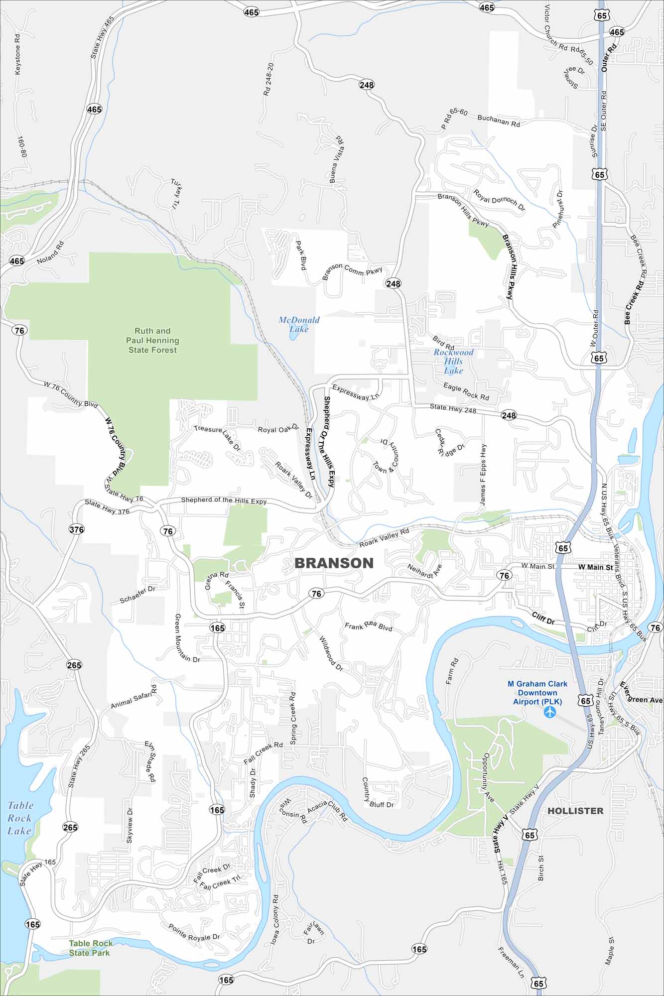
See Branson with our road map. Tourism dominates but the Ozarks give it a natural backdrop. A key feature here is Table Rock Lake. It’s known for music, shows, and scenery.
Map Information
On the Map
Interstates/Highways: US Hwy 65, State Rte 76, State Rte 248, State Rte 465, State Rte 165, State Rte 376, State Rte 265 Major Roads: Main St, Branson Hills Pkwy, Shepherd of the Hills Expy, Roark Valley Rd, Fall Creek Rd, Gretna Rd, Forsythe Rd, Bee Creek Rd, Veterans Blvd, Epps Hwy, Cliff Dr, Wildwood Dr, Green Mountain Dr, Skyview Dr, Blue Ridge Dr, Outer Rd Airports: M Graham Clark Downtown Airport Lakes and Reservoirs: McDonald Lake, Rockwood Hills Lake, Table Rock Lake Parks and Preserves: Table Rock State Park Nearby Communities: HollisterMissouri State Maps
Check out state maps of the Show-Me State.


Missouri City Maps
Here are our city maps for Missouri


