Map of Bluffton, South Carolina
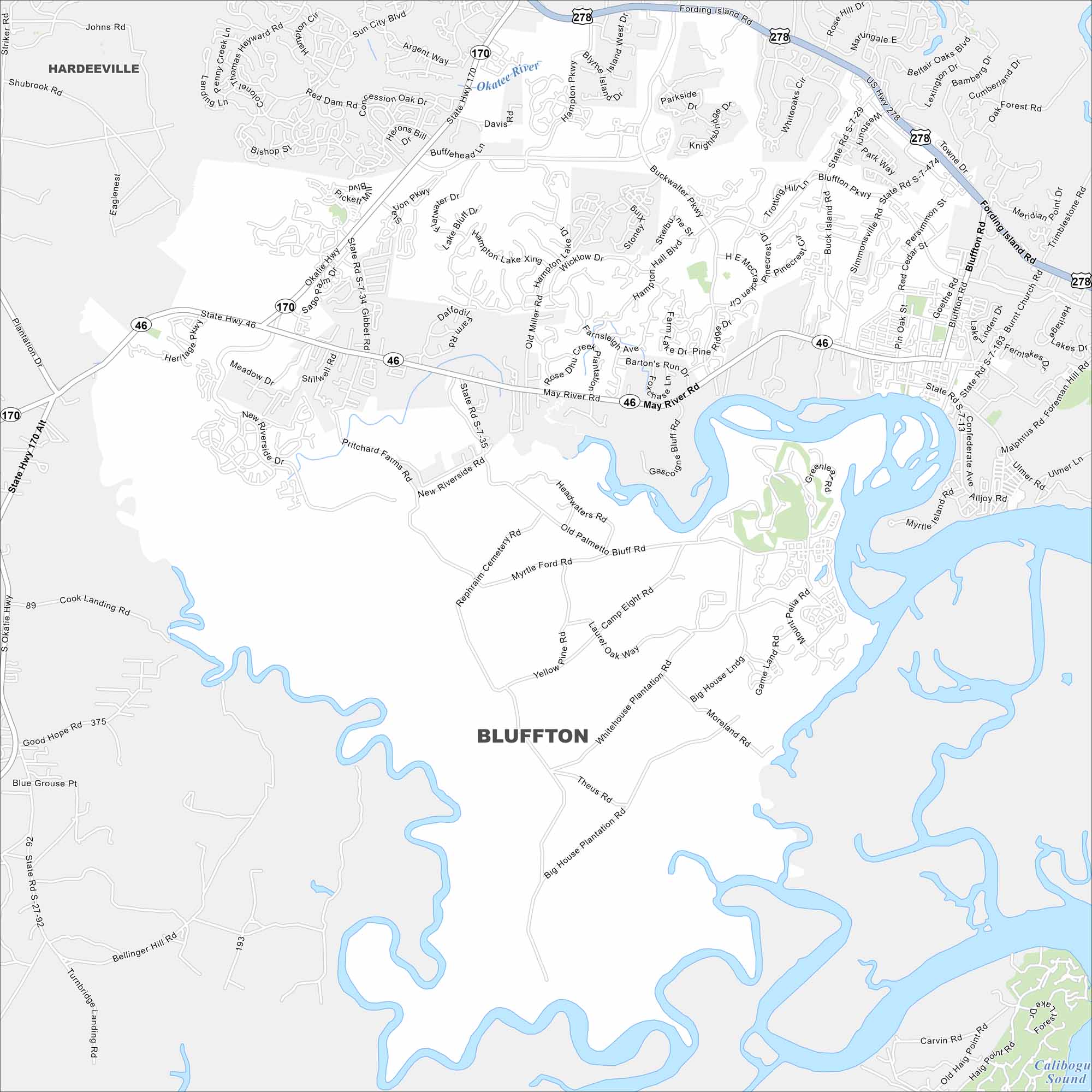
See the streets, highways, and marshland edges on this map. The city is known for its Lowcountry charm and views of the May River. Our map of Bluffton highlights its layout beside tidal creeks.
Map Information
On the Map
Interstates/Highways: US Hwy 278, State Rte 46, State Rte 170 Major Roads: Fording Island Rd, May River Rd, Bluffton Pkwy, Okatie Hwy, Buckwalter Pkwy, New Riverside Dr, Burnt Church Rd, Simmonsville Rd, Goethe Rd, Sheridan Park Cir, Red Dam Rd, Bluffton Rd, Malphrus Rd, Foreman Hill Rd, Alljoy Rd, Pritchard Farms Rd, Ulmer Ln, Gascoigne Bluff Rd, Pin Oak St, Persimmon St Major Rivers: Okatie River Nearby Communities: HardeevilleSouth Carolina State Maps
Explore maps across the Palmetto State.


City Maps of South Carolina
Find our maps of Charleston and South Carolina cities here


