Map of Blue Springs, Missouri
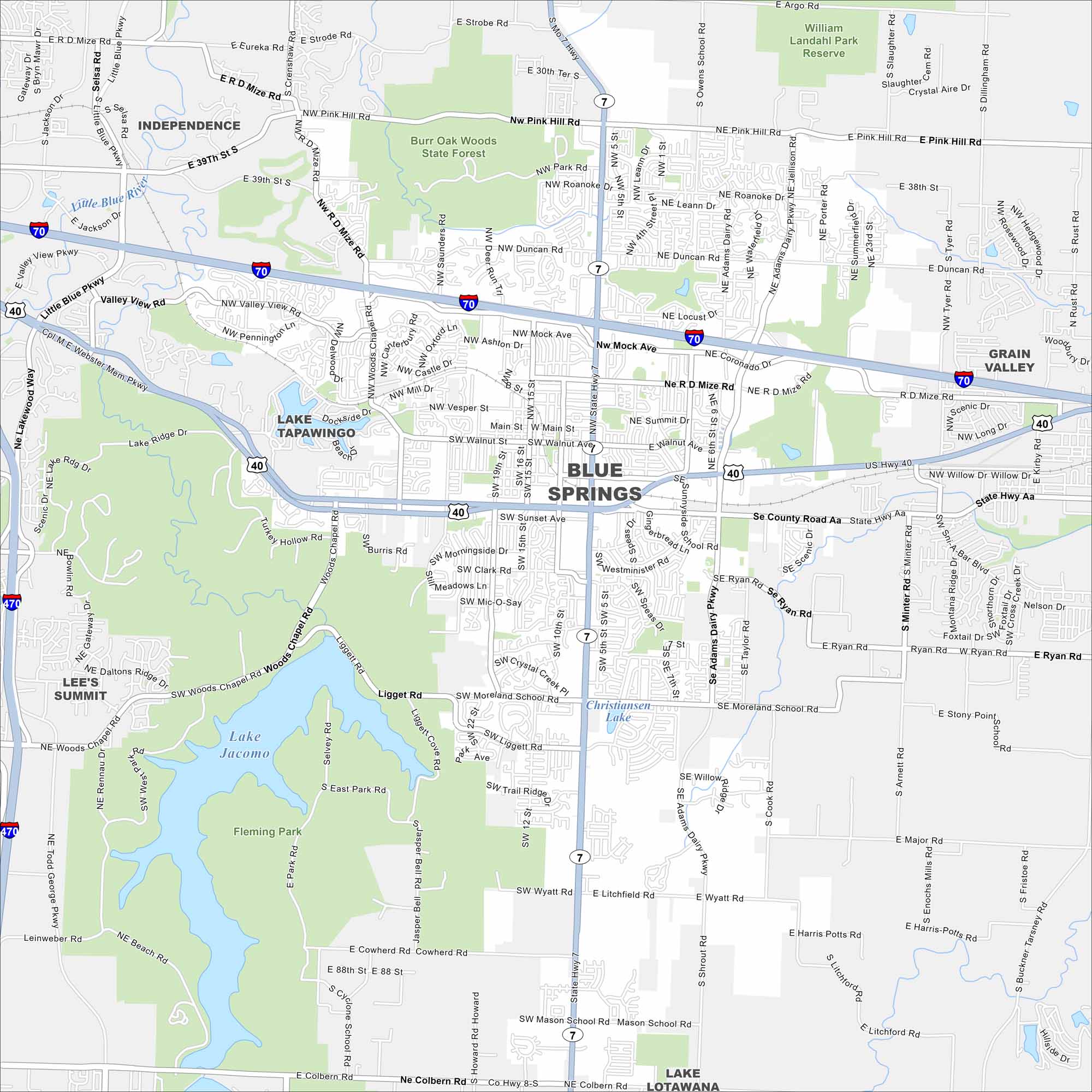
We’ve mapped out Blue Springs with its highways, streets, and nearby lakes. The roads tie into Kansas City but the community has its own identity. It’s known for Lake Jacomo and Fleming Park.
Map Information
On the Map
Interstates/Highways: I-70, US Hwy 40, State Rte 7, State Rte 470 Major Roads: Adams Dairy Pkwy, Moreland School Rd, Jefferson St, Sunnyside Rd, Duncan Rd, Liggett Rd, Vesper St, Walnut St, Main St, Pink Hill Rd, Wyatt Rd, Mason School Rd, Colbern Rd, Major Rd, Ryan Rd, Woods Chapel Rd, Valley View Rd, Mock Ave, Roanoke Rd, 7 Hwy Lakes and Reservoirs: Lake Jacomo, Christiansen Lake Major Rivers: Little Blue River Parks and Preserves: Burr Oak Woods State Forest, Fleming Park, William Landahl Park Reserve Nearby Communities: Independence, Grain Valley, Lee’s SummitMissouri State Maps
Check out state maps of the Show-Me State.


Missouri City Maps
Here are our city maps for Missouri


