Map of Bloomington, Illinois
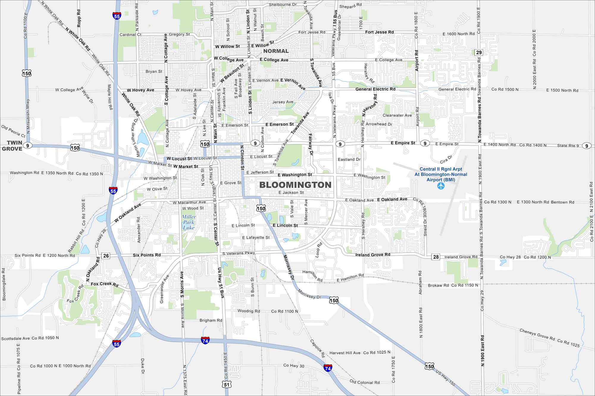
Bloomington is a central Illinois hub. Our map highlights roads, neighborhoods, and nearby parks. The city is tied to agriculture but also serves as a regional business center.
Illinois State Maps
Get to know Illinois with our state maps


Map Information
On the Map
Interstates/Highways: I-55, I-74, US Hwy 51, US Hwy 150, State Rte 9 Major Roads: Veterans Pkwy, Empire St, Main St, College Ave, Washington St, Oakland Ave, Market St, Locust St, Towanda Ave, Airport Rd, Hershey Rd, Ireland Grove Rd, Clinton St, Linden St, Center St, Six Points Rd, Morris Ave, Bunn St, Morrissey Dr, Beich Rd Airports: Central IL Rgnl Arpt At Bloomington-Normal Airport (BMI) Lakes and Reservoirs: Miller Park Lake Nearby Communities: Normal, Twin GroveIllinois City Maps
Explore Chicago and urban regions of Illinois


