Map of Blacksburg, Virginia
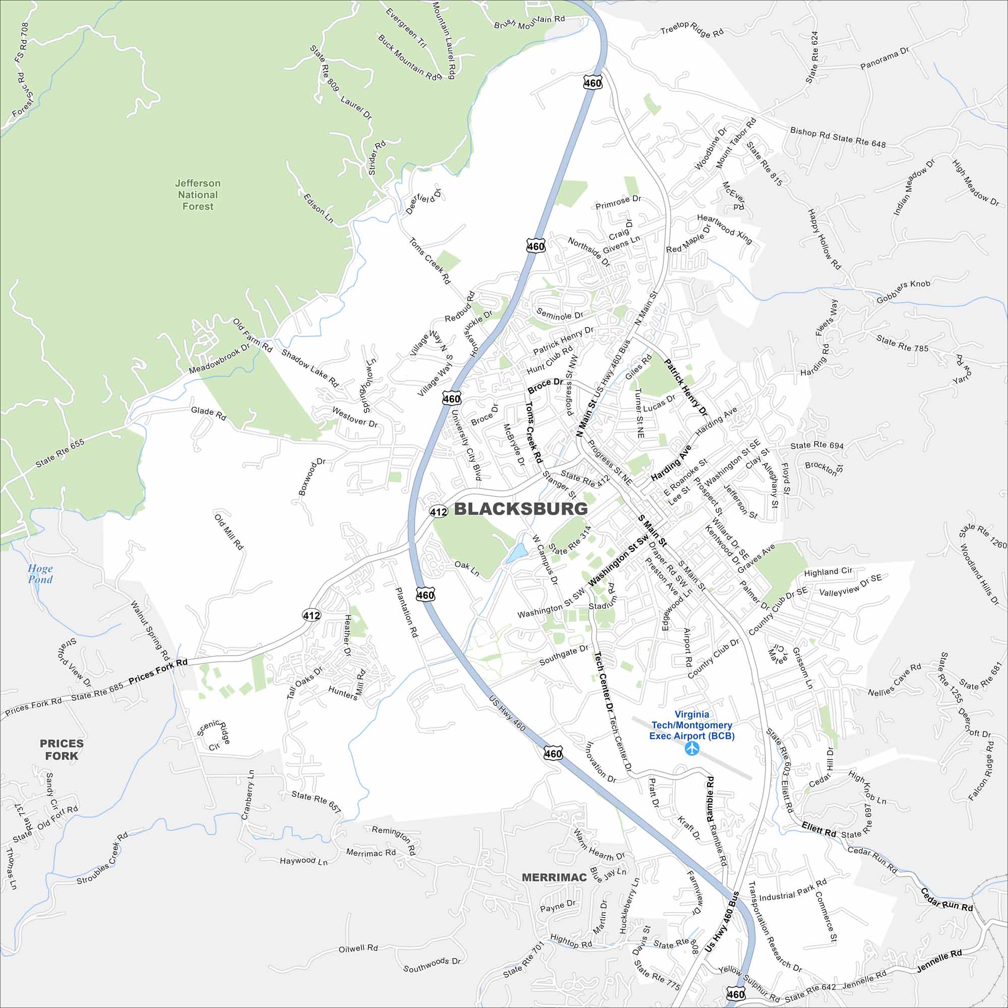
We’ve mapped Blacksburg with its streets, highways, and parks. The roads connect to the Blue Ridge. It’s best known as the home of Virginia Tech.
Map Information
On the Map
Interstates/Highways: US Hwy 460, State Rte 412 Major Roads: Main St, Prices Fork Rd, Toms Creek Rd, Washington St, University City Blvd, Patrick Henry Dr, Harding Ave, Patrick Henry Dr, Southgate Dr, Glade Rd, Merrimac Rd, Tall Oaks Dr, Litton-Reaves Dr, Clay St, Roanoke St, Progress St, Giles Rd, Airport Rd, Ramble Rd, Huckleberry Ln Airports: Virginia Tech/Montgomery Exec Airport (BCB) Lakes and Reservoirs: Hoge Pond Parks and Preserves: Jefferson National Forest Nearby Communities: Prices Fork, MerrimacVirginia State Maps
Spanning coasts and mountains, here are our maps of Virginia.


City Maps of Virginia
Traverse Virginia using our city maps


