Map of Belleville, Illinois
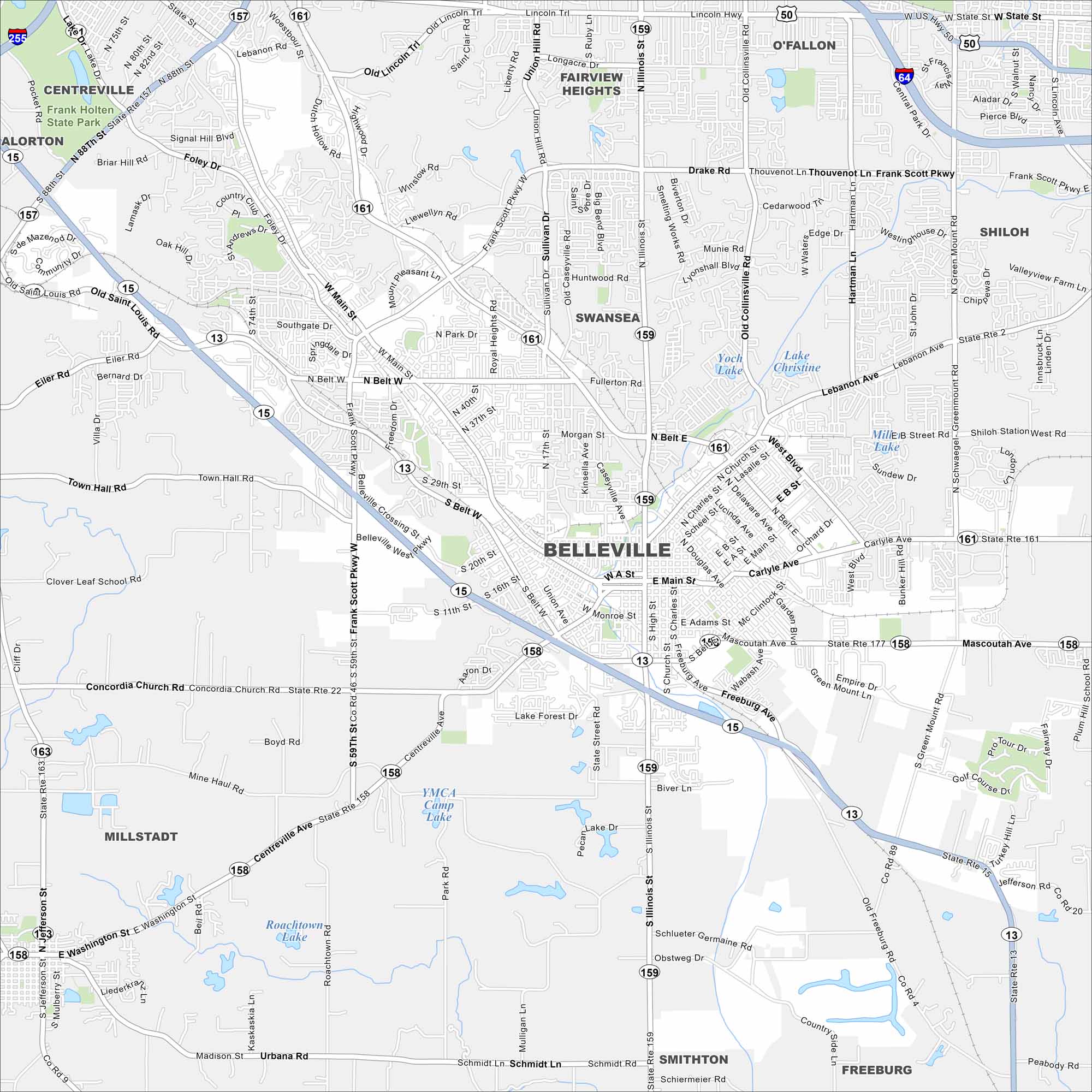
Our map of Belleville highlights the highways, streets, and park spaces. Roads link into the St. Louis area but the city stands on its own. Belleville is known for its historic downtown and German roots.
Illinois State Maps
Get to know Illinois with our state maps


Map Information
On the Map
Interstates/Highways: I-64, I-255, State Rte 15, State Rte 13, State Rte 157, State Rte 161, State Rte 159, State Rte 158, State Rte 177 Major Roads: Main St, Belt W, Belt E, Frank Scott Pkwy, Carlyle Ave, Freeburg Ave, Illinois St, Sullivan Dr, Lebanon Ave, Mascoutah Ave, Centerville Ave, Washington St, Green Mount Ln, Briverton Rd, West Blvd, Douglas Ave, Southgate Dr, Foley Dr, Signal Hill Blvd, 88th St Lakes and Reservoirs: Lake Christine, Biver Lake, YMCA Camp Lake, Roachtown Lake Parks and Preserves: Frank Holten State Park Nearby Communities: Centreville, Fairview Heights, O’Fallon, Shiloh, Swansea, Smithton, Freeburg, Millstadt, AlortonIllinois City Maps
Explore Chicago and urban regions of Illinois


