Map of Alexandria, Virginia
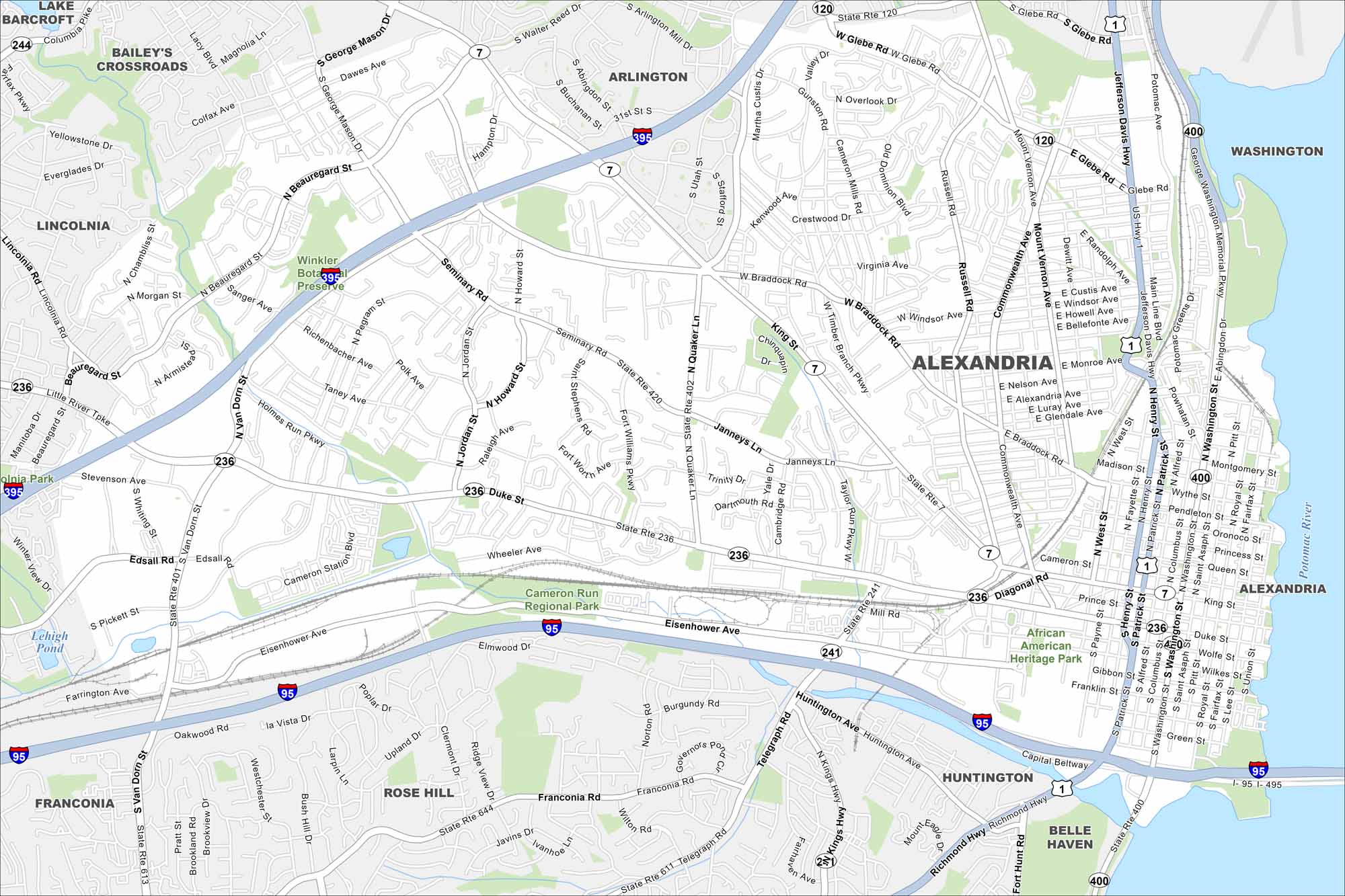
Cobblestone streets make way for a busy waterfront in Alexandria. Our map displays its neighborhoods along the Potomac. But Old Town stands out as the historic heart.
Map Information
On the Map
Interstates/Highways: I-95, I-395, I-495, US Hwy 1, State Rte 7, State Rte 120, State Rte 236, State Rte 241, State Rte 400, State Rte 420 Major Roads: Jefferson Davis Hwy, Duke St, Washington St, Eisenhower Ave, King St, Richmond Hwy, Telegraph Rd, Glebe Rd, Braddock Rd, Commonwealth Ave, Mount Vernon Ave, Russell Rd, Van Dorn St, Beauregard St, Jordan St, Henry St, Patrick St, Union St, Seminary Rd, Janneys Ln Major Rivers: Potomac River Parks and Preserves: Winkler Botanical Preserve, Cameron Run Regional Park, African American Heritage Park Nearby Communities: Barcroft, Bailey’s Crossroads, Lincolnia, Arlington, Rose Hill, Huntington, Belle Haven, WashingtonVirginia State Maps
Spanning coasts and mountains, here are our maps of Virginia.


City Maps of Virginia
Traverse Virginia using our city maps


