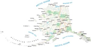
Alaska Physical Map
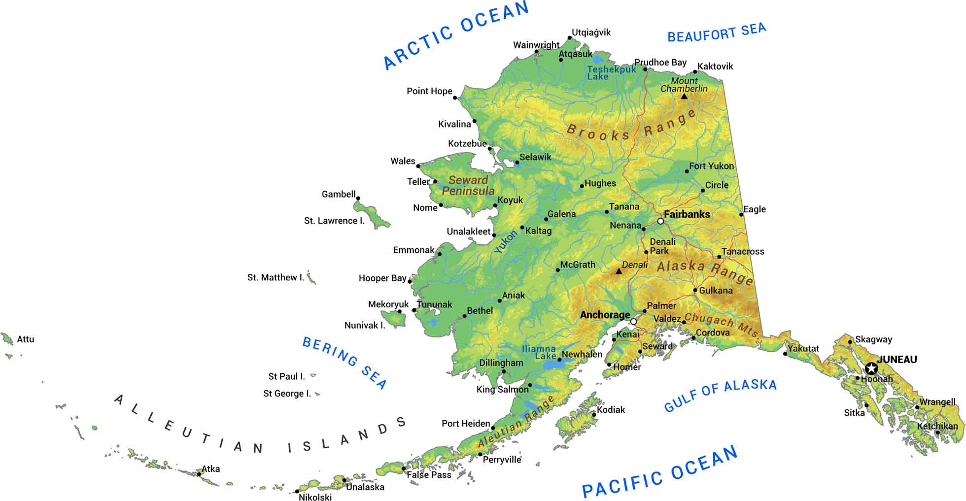
Alaska is massive and wild. The Alaska Range cuts through the interior with Denali towering at over 20,000 feet. Glaciers, fjords, and jagged coastline dominate the south while tundra spreads across the north. We’ve mapped the mountains, rivers, and brutal terrain that makes this the last frontier.
Map Information
On the Map
Physical State Maps
Select any state map below to view its physical map.


Alaska State Maps
Take a look at our Alaska state maps