Satellite Map of Alabama
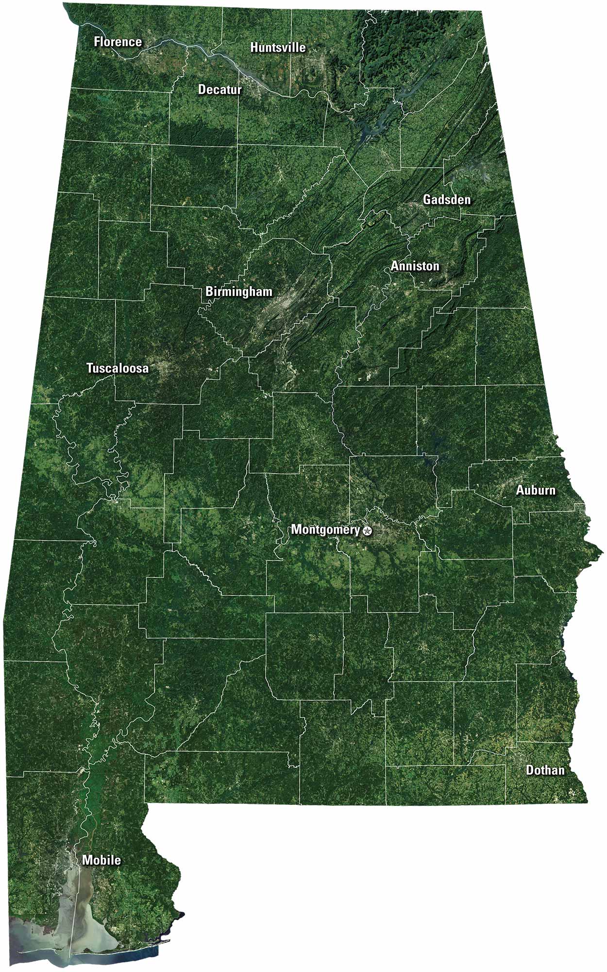
Get to know Alabama a bit better with our satellite map. Cities like Birmingham, Montgomery, and Huntsville stand out. You can follow the Tennessee River across the north. Down south, the Gulf Coast shines with bays, beaches and the City of Mobile. It’s a view of both mountains and shoreline.
Map Information
On the Map
Neighboring State Maps
Find satellite map of neighboring states


