Map of Addison, Illinois
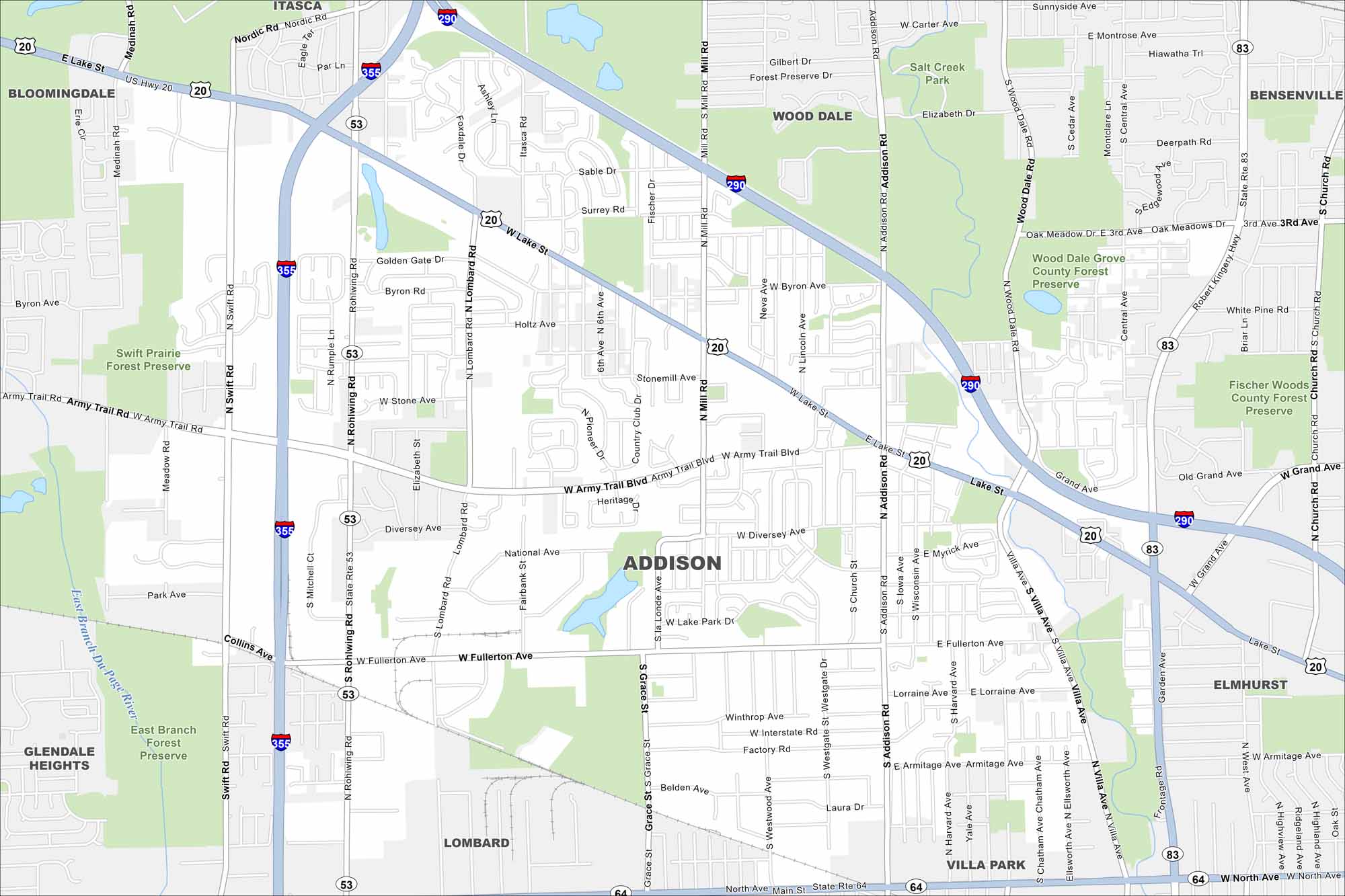
Our map of Addison shows a dense suburban community just west of Chicago. It has busy roads, industrial parks, and a connection to the metro area.
Illinois State Maps
Get to know Illinois with our state maps


Map Information
On the Map
Interstates/Highways: I-355, I-290, US Hwy 20, State Rte 53, State Rte 64 Major Roads: Lake St, Army Trail Blvd, North Ave, Addison Rd, Lombard Rd, Fullerton Ave, Mill Rd, Swift Rd, Rohwing Rd, Villa Ave, Wood Dale Rd, Rohlwing Rd, Grace St, Diversey Ave, Elizabeth St, Stone Ave, Westgate Dr, Byron Rd, National Ave, Collins Ave Major Rivers: East Branch Du Page River Parks and Preserves: Swift Prairie Forest Preserve, Wood Dale Grove County Forest Preserve, Fischer Woods County Forest Preserve, Salt Creek Park, East Branch Forest Preserve Nearby Communities: Itasca, Wood Dale, Bensenville, Elmhurst, Villa Park, Lombard, Glendale Heights, BloomingdaleIllinois City Maps
Explore Chicago and urban regions of Illinois


