Map of Aiken, South Carolina
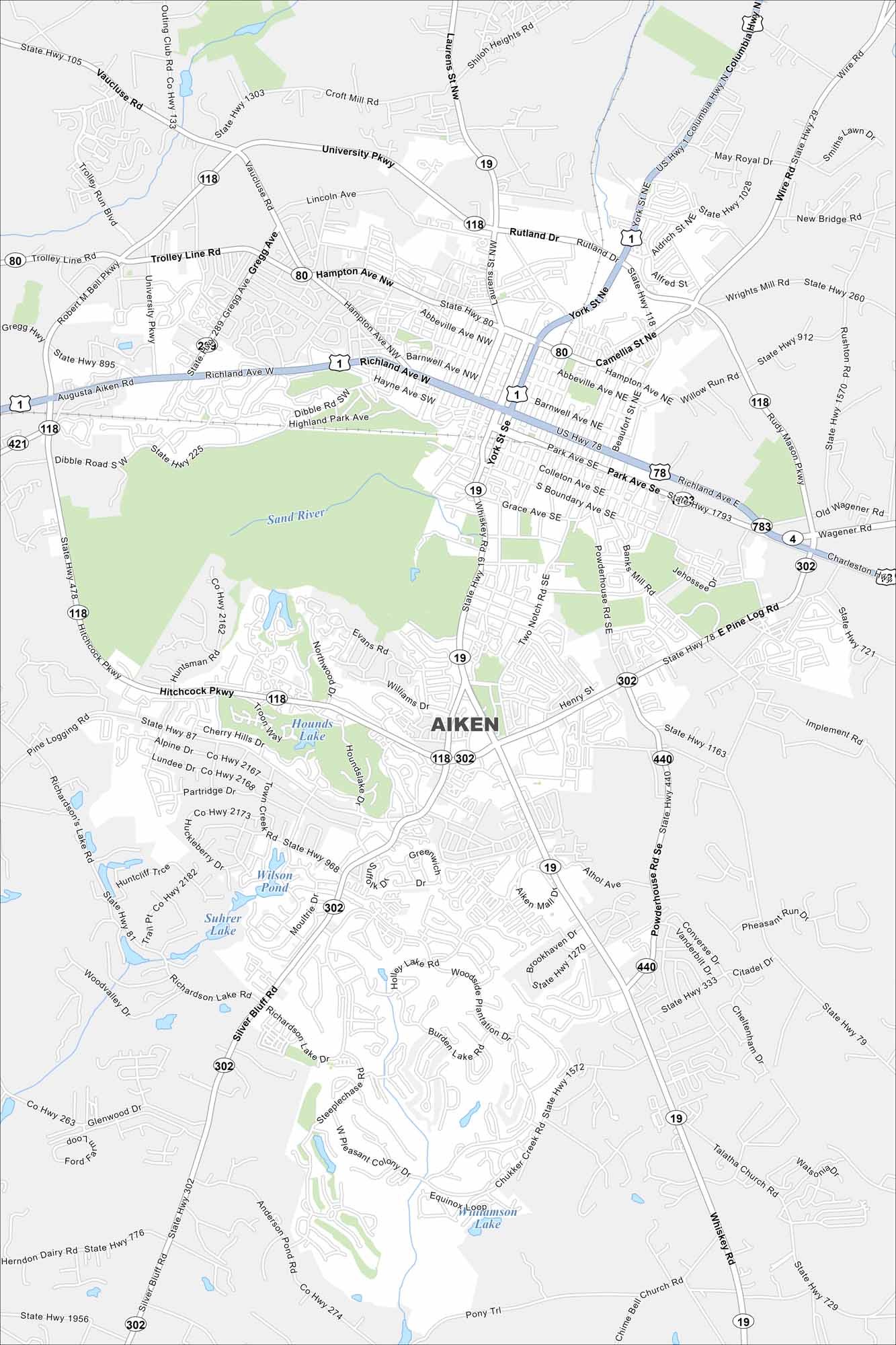
Our map of Aiken highlights its streets lined with parks and greenways. The city is known for horses and history. It’s set in the heart of South Carolina’s sandhills.
Map Information
On the Map
Interstates/Highways: US Hwy 1, US Hwy 78, US Hwy 301, US Hwy 278, State Rte 19, State Rte 80, State Rte 118, State Rte 225, State Rte 302, State Rte 421, State Rte 440, State Rte 783 Major Roads: University Pkwy, Richland Ave, Whiskey Rd, Hitchcock Pkwy, Silver Bluff Rd, Powderhouse Rd, Pine Log Rd, Beaufort St, Laurens St, York St, Rutland Rd, Trolley Line Rd, Gregg Ave, Vaucluse Rd, Croft Mill Rd, Wagener Rd, Charleston Hwy, Columbia Hwy, Chime Bell Church Rd, Chukker Creek Rd Lakes and Reservoirs: Wilson Pond, Suhrer Lake, Hounds Lake, Williamson Lake Major Rivers: Sand RiverSouth Carolina State Maps
Explore maps across the Palmetto State.


City Maps of South Carolina
Find our maps of Charleston and South Carolina cities here


