Map of American Fork, Utah
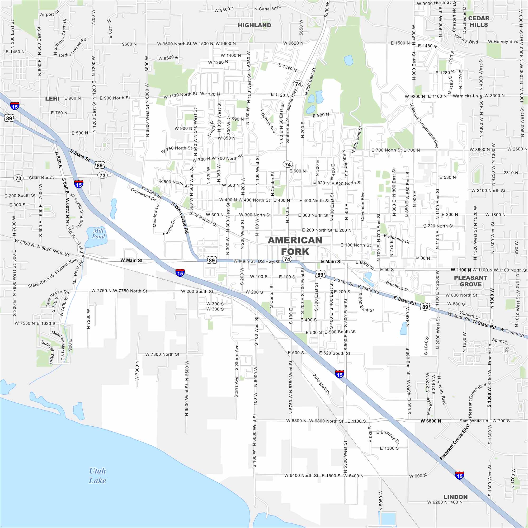
Situated near Utah Lake, American Fork sits at the mouth of a canyon that leads straight into the mountains. Our map shows its highways and streets. The city has some of the state’s best outdoor access.
Map Information
On the Map
Interstates/Highways: I-15, US Hwy 89, State Rte 74, State Rte 73, State Rte 145 Major Roads: Main St, State Rd, Pioneer Xing, Pacific Dr, Meadows Ln, Grassland Dr, 100 West St, Center St, 100 East St, 200 East St, 500 East St, 700 East St, 900 East St, 1100 East St, 2000 West St, 500 North St, 700 North St, 1120 North St, 9600 North St, Auto Mall Dr Lakes and Reservoirs: Utah Lake, Mill Pond Nearby Communities: Lehi, Highland, Cedar Hills, Pleasant Grove, LindonUtah State Maps
Look through maps of deserts, parks, and cities.


City Maps of Utah
Here is Salt Lake City and Utah’s urban regions.


