Map of Arlington Heights, Illinois
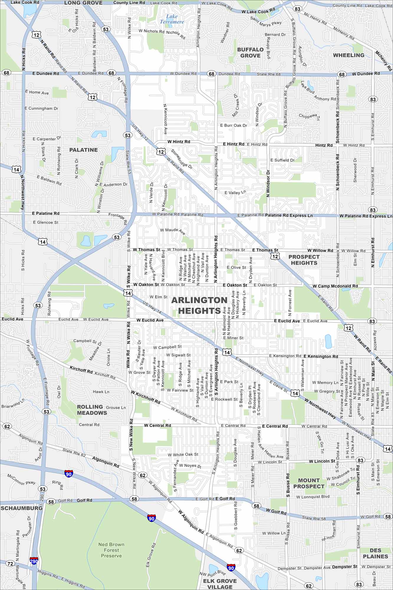
Our map of Arlington Heights lays out the roadways, waterways, and local parks. Roads tie into Chicago, which is located to the southeast. There is a neat former racetrack here that’s worth a look.
Illinois State Maps
Get to know Illinois with our state maps


Map Information
On the Map
Interstates/Highways: I-290, I-90, US Hwy 12, US Hwy 14, State Rte 53, State Rte 68, State Rte 83, State Rte 62, State Rte 58 Major Roads: Dundee Rd, Palatine Rd, Northwest Hwy, Rand Rd, Central Rd, Golf Rd, Arlington Heights Rd, Wilke Rd, Euclid Ave, Main St, Algonquin Rd, Hintz Rd, Lake Cook Rd, Buffalo Grove Rd, Schoenbeck Rd, Elmhurst Rd, Busse Rd, Goebbert Rd, Kennicott Ave, Windsor Dr Lakes and Reservoirs: Lake Terramere Parks and Preserves: Ned Brown Forest Preserve Nearby Communities: Long Grove, Buffalo Grove, Wheeling, Prospect Heights, Mount Prospect, Des Plaines, Elk Grove Village, Schaumburg, Rolling Meadows, PalatineIllinois City Maps
Explore Chicago and urban regions of Illinois


