Map of Barrington, Illinois
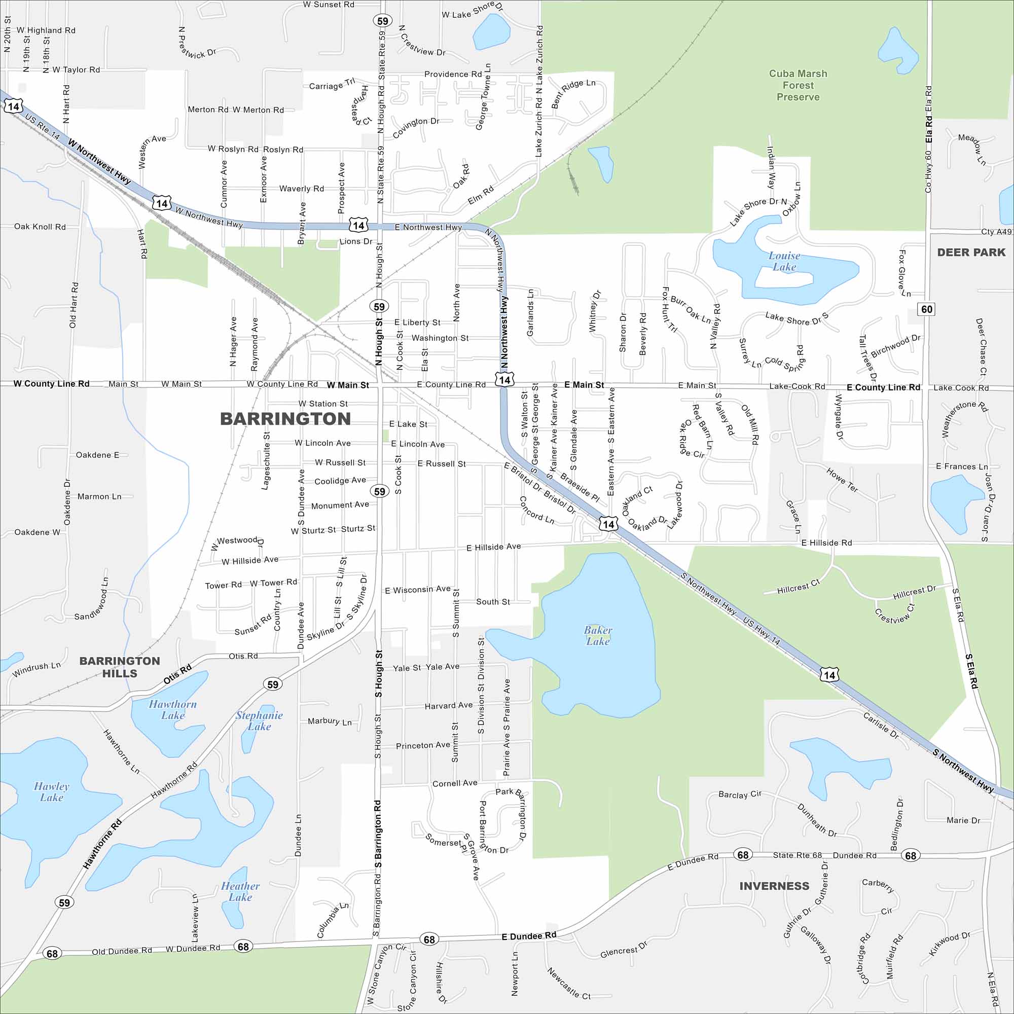
Barrington is mapped with its streets, highways, and surrounding green areas. The roads connect toward Chicago. But the village still sits in horse country with its historic homes and preserves.
Illinois State Maps
Get to know Illinois with our state maps


Map Information
On the Map
Interstates/Highways: US Hwy 14, State Rte 59, State Rte 68, State Rte 60, Northwest Hwy Major Roads: Main St, Lake Cook Rd, Hough St, Barrington Rd, Dundee Rd, County Line Rd, Ela Rd, Brinker Rd, Otis Rd, Hillside Ave, Hart Rd, Eastern Ave, Lake St, Station St, Liberty St, Washington St, Russell St, Illinois Ave, Wisconsin Ave Lakes and Reservoirs: Baker Lake, Lake Shore Dr, Louise Lake, Hawthorn Lake, Stephanie Lake, Heather Lake, Hawley Lake Parks and Preserves: Cuba Marsh Forest Preserve Nearby Communities: Deer Park, Inverness, Barrington HillsIllinois City Maps
Explore Chicago and urban regions of Illinois


