Map of Beaufort, South Carolina
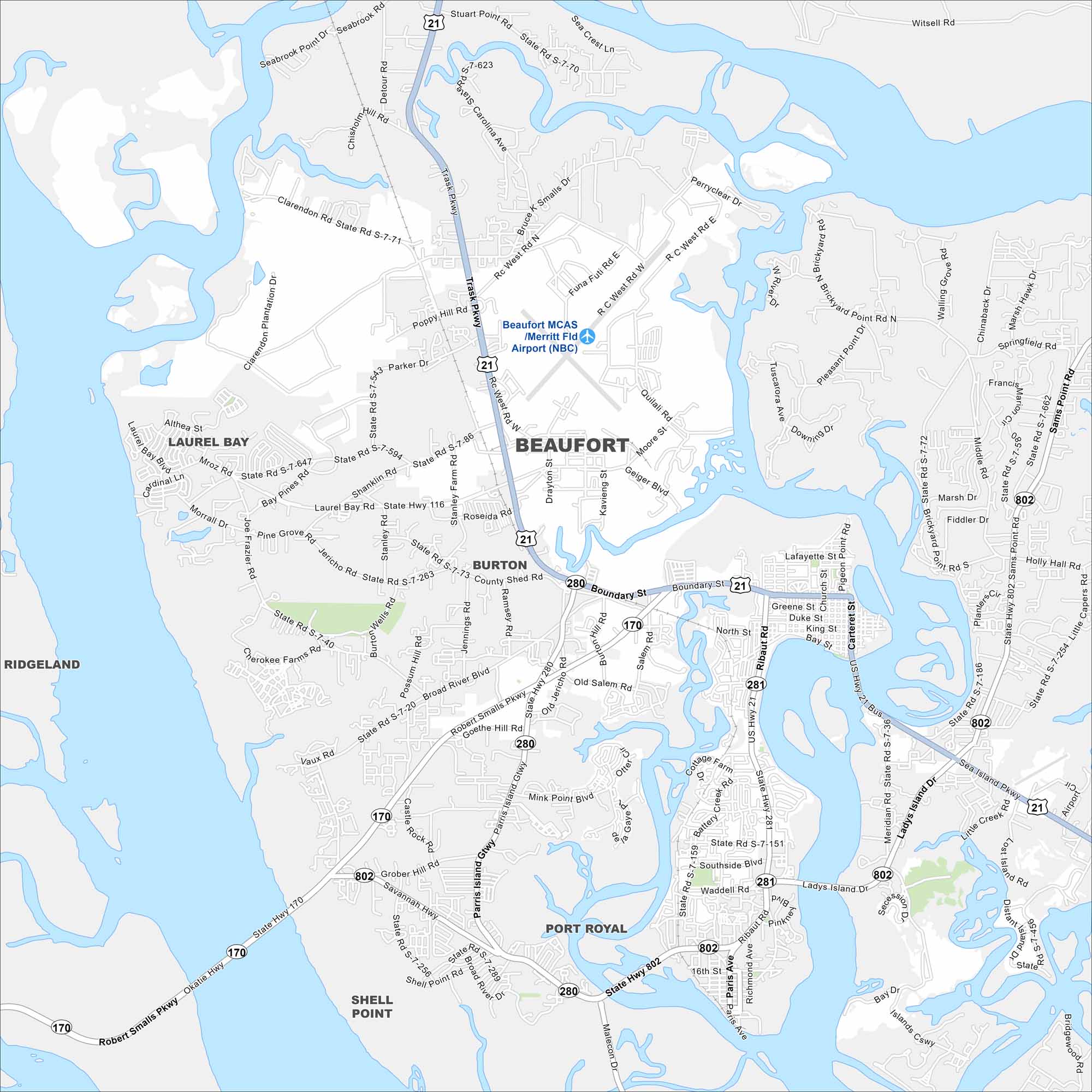
Our map of Beaufort highlights the tidal rivers, marshes, and islands. The city is on Port Royal Island along the South Carolina coast. It’s famous for its waterfront and historic sites.
Map Information
On the Map
Interstates/Highways: US Hwy 21, State Rte 170, State Rte 280, State Rte 281, State Rte 802 Major Roads: Boundary St, Ribaut Rd, Parris Island Gtwy, Robert Smalls Pkwy, Sea Island Pkwy, Ladys Island Dr, Sams Point Rd, Brickyard Pt Rd, Trask Pkwy, Savannah Hwy, Okatie Hwy, Salem Rd, Burton Hill Rd, Depot Rd, Old Salem Rd, Bay St, Carteret St, Meridian Rd, Miller Dr, Holly Hall Rd Airports: Beaufort MCAS / Merritt Fld Airport (NBC) Nearby Communities: Port Royal, Laurel Bay, Burton, Shell Point, RidgelandSouth Carolina State Maps
Explore maps across the Palmetto State.


City Maps of South Carolina
Find our maps of Charleston and South Carolina cities here


