Map of Berwyn, Illinois
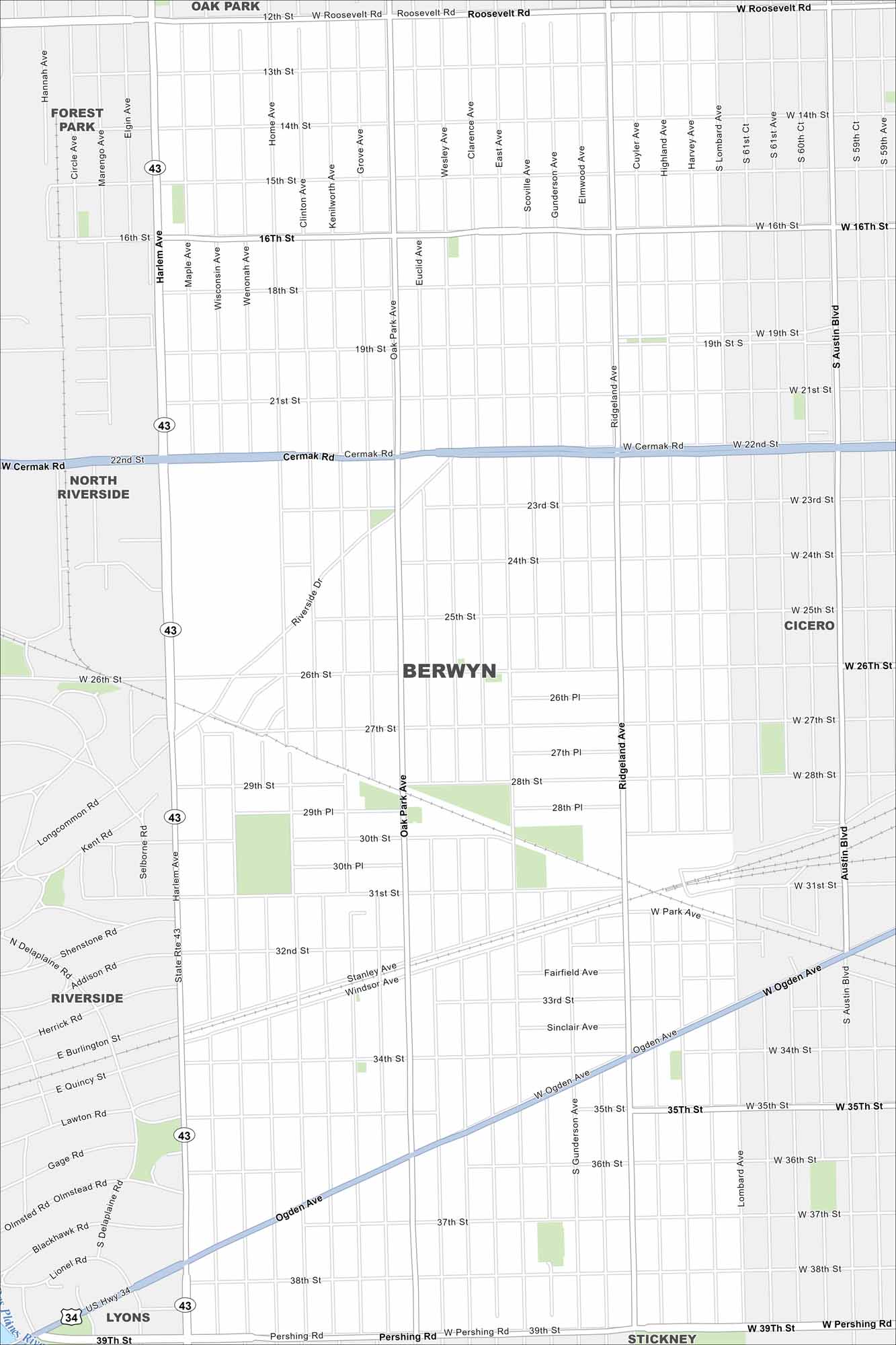
Berwyn is a near-west suburb of Chicago. Our map outlines grid-style streets, rail lines, and neighborhood parks. It’s known for its historic bungalows.
Illinois State Maps
Get to know Illinois with our state maps


Map Information
On the Map
Interstates/Highways: US Hwy 34, State Rte 43 Major Roads: Cermak Rd, Ogden Ave, Roosevelt Rd, Pershing Rd, Harlem Ave, Ridgeland Ave, Austin Blvd, 16th St, 22nd St, 26th St, 31st St, 34th St, 39th St, Oak Park Ave, Lombard Ave, Home Ave, Clinton Ave, Kenilworth Ave, Euclid Ave, Gunderson Ave Major Rivers: Des Plaines River Nearby Communities: Oak Park, Cicero, Stickney, Lyons, Riverside, North Riverside, Forest ParkIllinois City Maps
Explore Chicago and urban regions of Illinois


