Map of Cary, Illinois
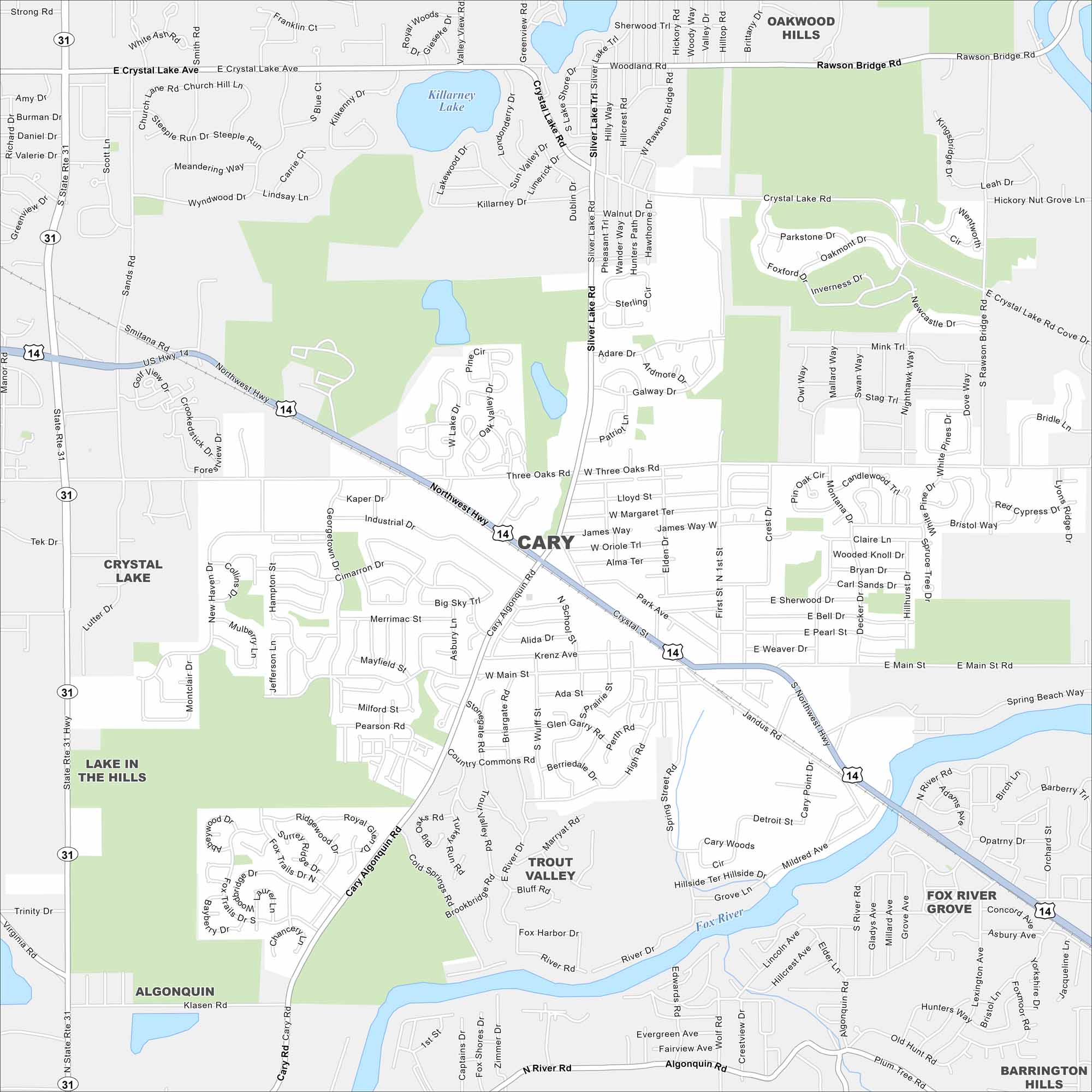
Explore Cary with our map, a village in northern Illinois. It sits along the Fox River with a mix of residential streets and green spaces.
Illinois State Maps
Get to know Illinois with our state maps


Map Information
On the Map
Interstates/Highways: US Hwy 14, State Rte 31, Northwest Hwy Major Roads: Cary Algonquin Rd, Main St, Three Oaks Rd, Crystal Lake Rd, Silver Lake Rd, Rawson Bridge Rd, Jandus Rd, First St, High Rd, Spring Rd, Klasen Rd, Fox Trails Dr, Kaper Dr, Industrial Dr, Georgetown Dr, W Main St, Woodridge Dr, Deckert Dr, Hilltop Rd Lakes and Reservoirs: Killarney Lake Major Rivers: Fox River Parks and Preserves: Cary Woods, Fox Trails, Sands Rd, Cary Algonquin Rd, Trout Valley Nearby Communities: Crystal Lake, Oakwood Hills, Fox River Grove, Trout Valley, Algonquin, Barrington Hills, Lake in the HillsIllinois City Maps
Explore Chicago and urban regions of Illinois


