Map of Cicero, Illinois
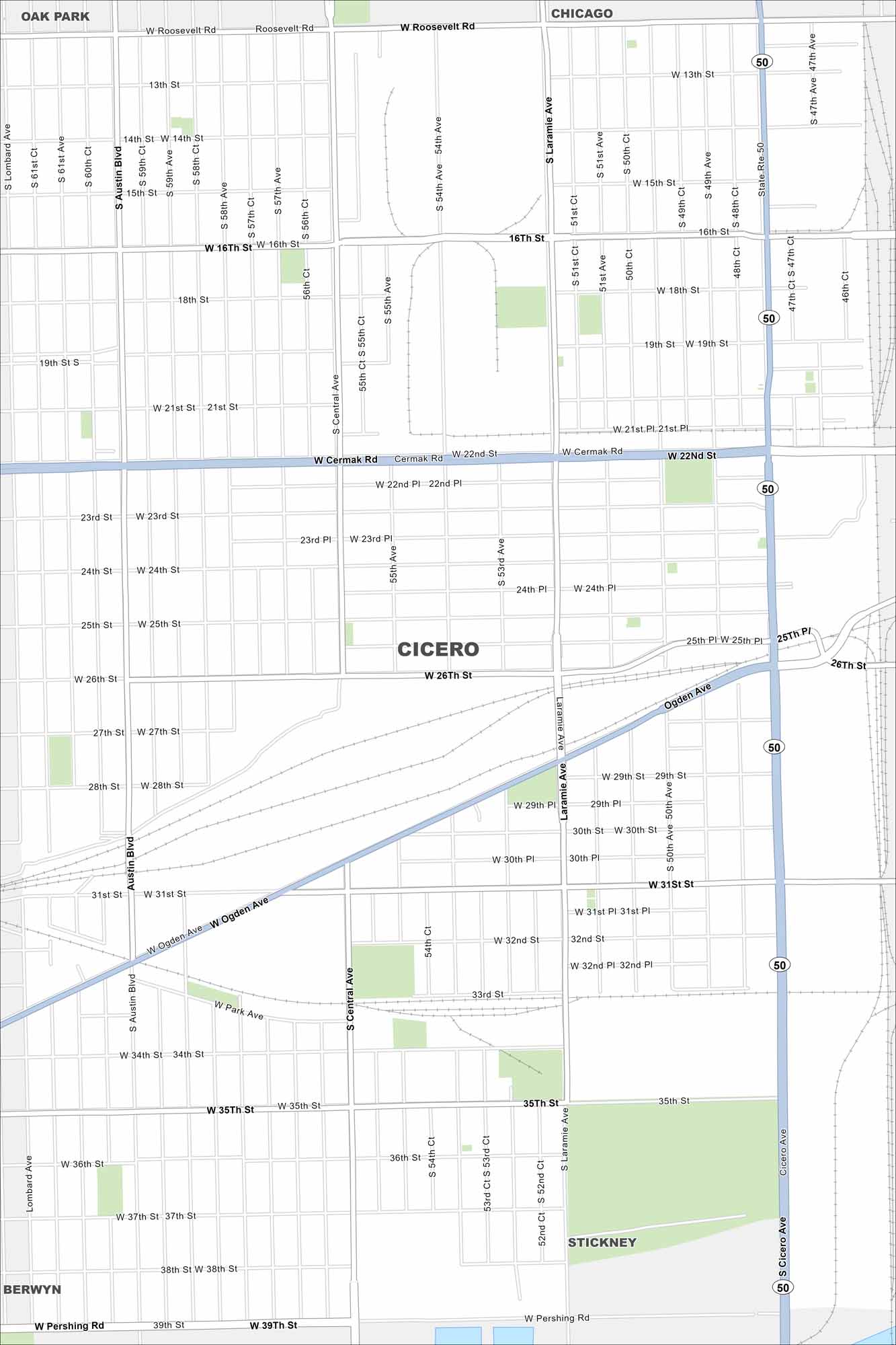
See Cicero with its grid of streets, major highways, and rail lines. Our map puts it just west of Chicago. It has long been a dense industrial suburb. But the city’s layout is tightly packed and urban.
Illinois State Maps
Get to know Illinois with our state maps


Map Information
On the Map
Interstates/Highways: State Rte 50 Major Roads: Cicero Ave, 16th St, Cermak Rd, 26th St, 31st St, 35th St, Pershing Rd, Austin Blvd, Central Ave, Laramie Ave, Ogden Ave, 50th Ave, 54th St, 51st St, 47th St, 22nd St, 39th St, Lombard Ave Nearby Communities: Oak Park, Chicago, Berwyn, StickneyIllinois City Maps
Explore Chicago and urban regions of Illinois


