Map of Clemson, South Carolina
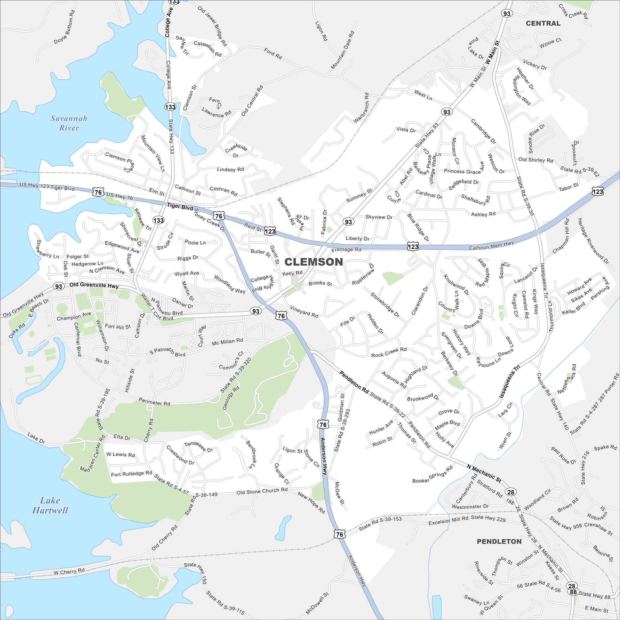
Our map of Clemson shows the city’s streets, highways, and lakefront. Home to Clemson University, it sits on the shores of Lake Hartwell. The Blue Ridge Mountains rise to the west.
Map Information
On the Map
Interstates/Highways: US Hwy 76, US Hwy 123, State Rte 28, State Rte 93, State Rte 133 Major Roads: Tiger Blvd, Anderson Hwy, College Ave, Issaqueena Trl, Pendleton Rd, Old Greenville Hwy, Perimeter Rd, Cherry Rd, Keowee Trl, Calhoun Dr, Mechanic St, Main St, Cambridge Dr, Berkeley Dr, Cambridge Dr, Old Stone Church Rd, Central Rd, Queen St, Westminister Dr, Sherard Rd Lakes and Reservoirs: Lake Hartwell Major Rivers: Savannah River Nearby Communities: Central, PendletonSouth Carolina State Maps
Explore maps across the Palmetto State.


City Maps of South Carolina
Find our maps of Charleston and South Carolina cities here


