Map of Columbia, South Carolina
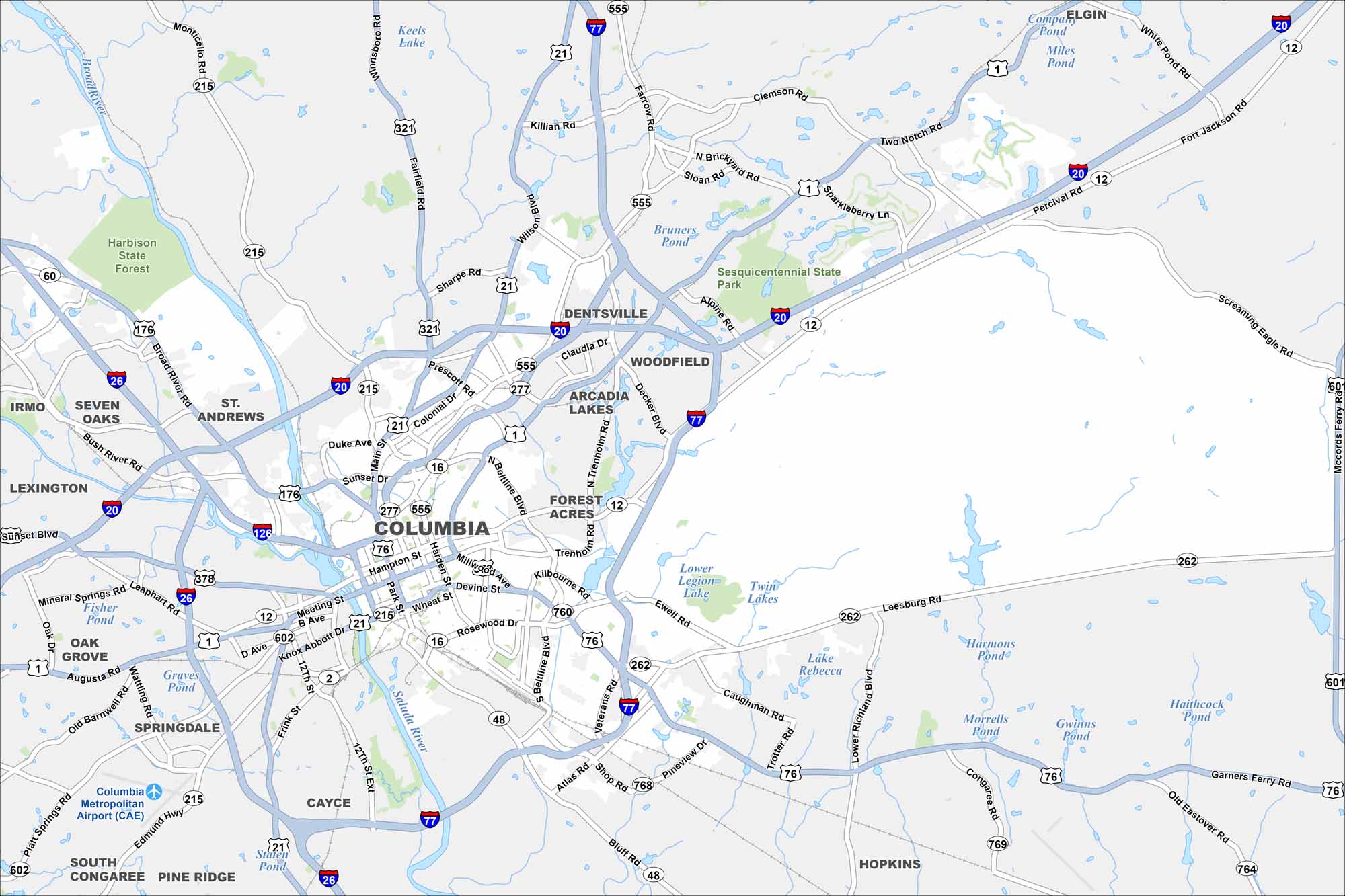
See our map of Columbia with its highways and rivers. As South Carolina’s capital, it sits where the Broad and Saluda Rivers join to form the Congaree. The city mixes history with a central location.
Map Information
On the Map
Interstates/Highways: I-20, I-26, I-77, I-126, US Hwy 1, US Hwy 21, US Hwy 76, US Hwy 176, US Hwy 321, US Hwy 378, US Hwy 601, State Rte 12, State Rte 16, State Rte 48, State Rte 215, State Rte 262, State Rte 277, State Rte 555, State Rte 602, State Rte 768, State Rte 769 Major Roads: Main St, Gervais St, Assembly St, Huger St, Bull St, Elmwood Ave, Taylor St, Harden St, Millwood Ave, Beltline Blvd, Trenholm Rd, Forest Dr, Two Notch Rd, Broad River Rd, Bush River Rd, Harbison Blvd, St Andrews Rd, Sunset Blvd, Knox Abbott Dr, Airport Blvd Airports: Columbia Metropolitan Airport (CAE) Lakes and Reservoirs: Keels Lake, Wilson Pond, Dents Pond, Twin Lakes, Lake Rebecca, Harmon Pond, Haithcock Pond, Staten Pond Major Rivers: Broad River, Saluda River, Congaree River Parks and Preserves: Harbison State Forest, Sesquicentennial State Park Nearby Communities: West Columbia, Cayce, Lexington, Irmo, Seven Oaks, St Andrews, Dentsville, Woodfield, Arcadia Lakes, Forest Acres, Springdale, South Congaree, Pine Ridge, Oak Grove, Hopkins, ElginSouth Carolina State Maps
Explore maps across the Palmetto State.


City Maps of South Carolina
Find our maps of Charleston and South Carolina cities here


