Map of West Chicago, Illinois
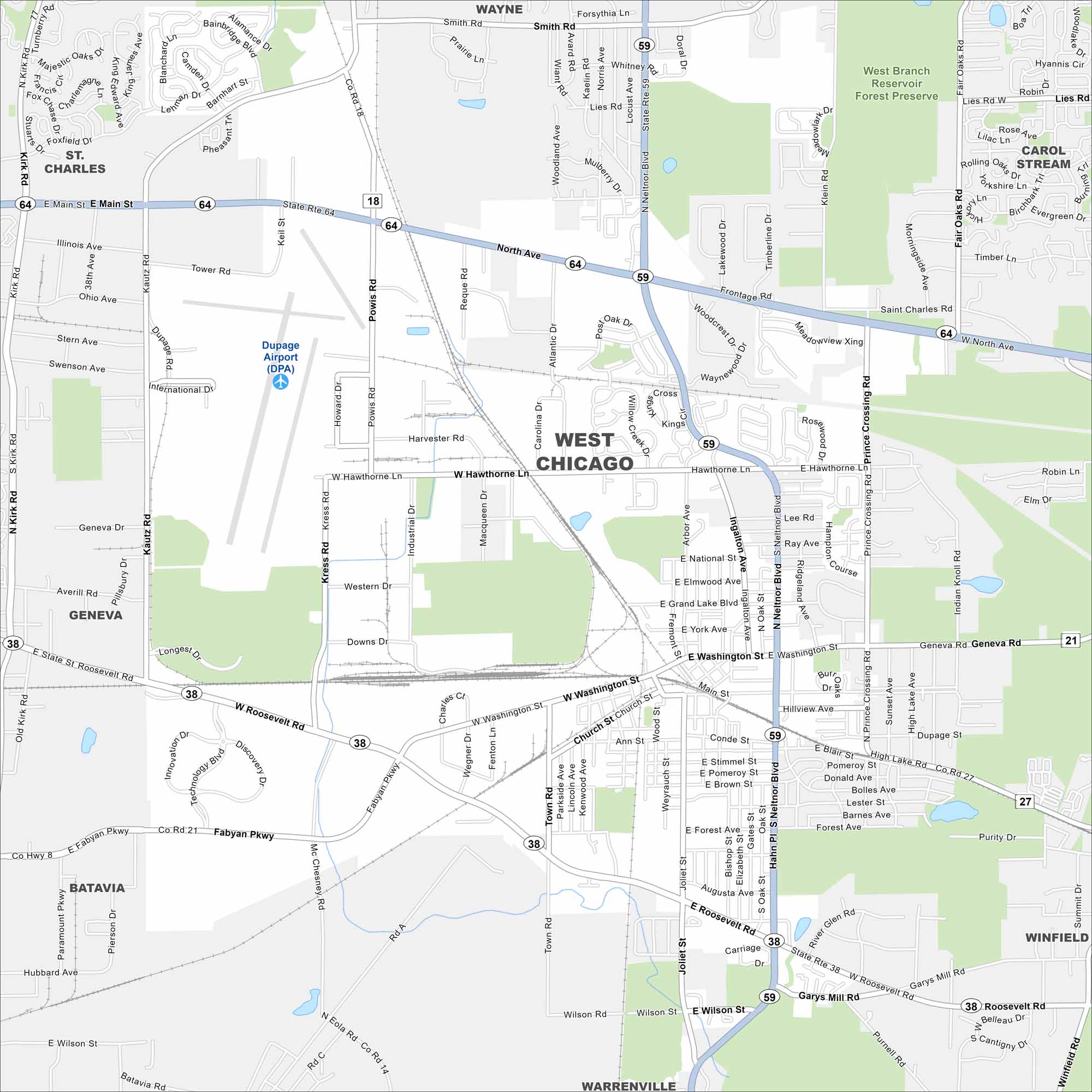
Here’s our map of West Chicago in DuPage County. Railroads, parks, and diverse neighborhoods shape the city’s layout. It’s located not too far away from the City of Chicago.
Illinois State Maps
Get to know Illinois with our state maps


Map Information
On the Map
Interstates/Highways: State Rte 64, State Rte 59, State Rte 38, State Rte 21 Major Roads: North Ave, Roosevelt Rd, Neltnor Blvd, Washington St, Fabyan Pkwy, Hawthorne Ln, Main St, Prince Crossing Rd, Wilson Rd, Garys Mill Rd, Kautz Rd, Powis Rd, Smith Rd, Atlantic Dr, Carolina Dr, Joliet St, Geneva Rd, Grand Lake Blvd, Elmwood Ave, National St Airports: Dupage Airport (DPA) Parks and Preserves: West Branch Reservoir Forest Preserve Nearby Communities: Wayne, Carol Stream, Winfield, Warrenville, Batavia, Geneva, St. CharlesIllinois City Maps
Explore Chicago and urban regions of Illinois


