Map of Crestwood, Illinois
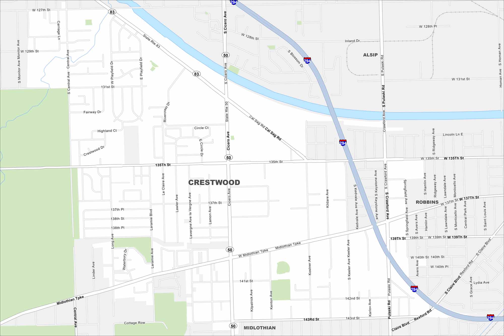
Get to know Crestwood, Illinois with our road map. This Chicago suburb lies near the Cal-Sag Channel. Green corridors break up the urban areas.
Illinois State Maps
Get to know Illinois with our state maps


Map Information
On the Map
Interstates/Highways: I-294, State Rte 50, State Rte 83 Major Roads: Cicero Ave, 135th St, 127th St, Midlothian Tpke, 143rd St, Pulaski Rd, Crawford Ave, Central Ave, Playfield Dr, Circle Ct, Keeler Ave, Kedvale Ave, Springfield Ave, Hamlin Ave, Ridgeway Ave, Lawndale Ave, Monticello Ave, Central Park Ave, Homan Ave, Claire Blvd Nearby Communities: Alsip, Robbins, MidlothianIllinois City Maps
Explore Chicago and urban regions of Illinois


