Map of Decatur, Illinois
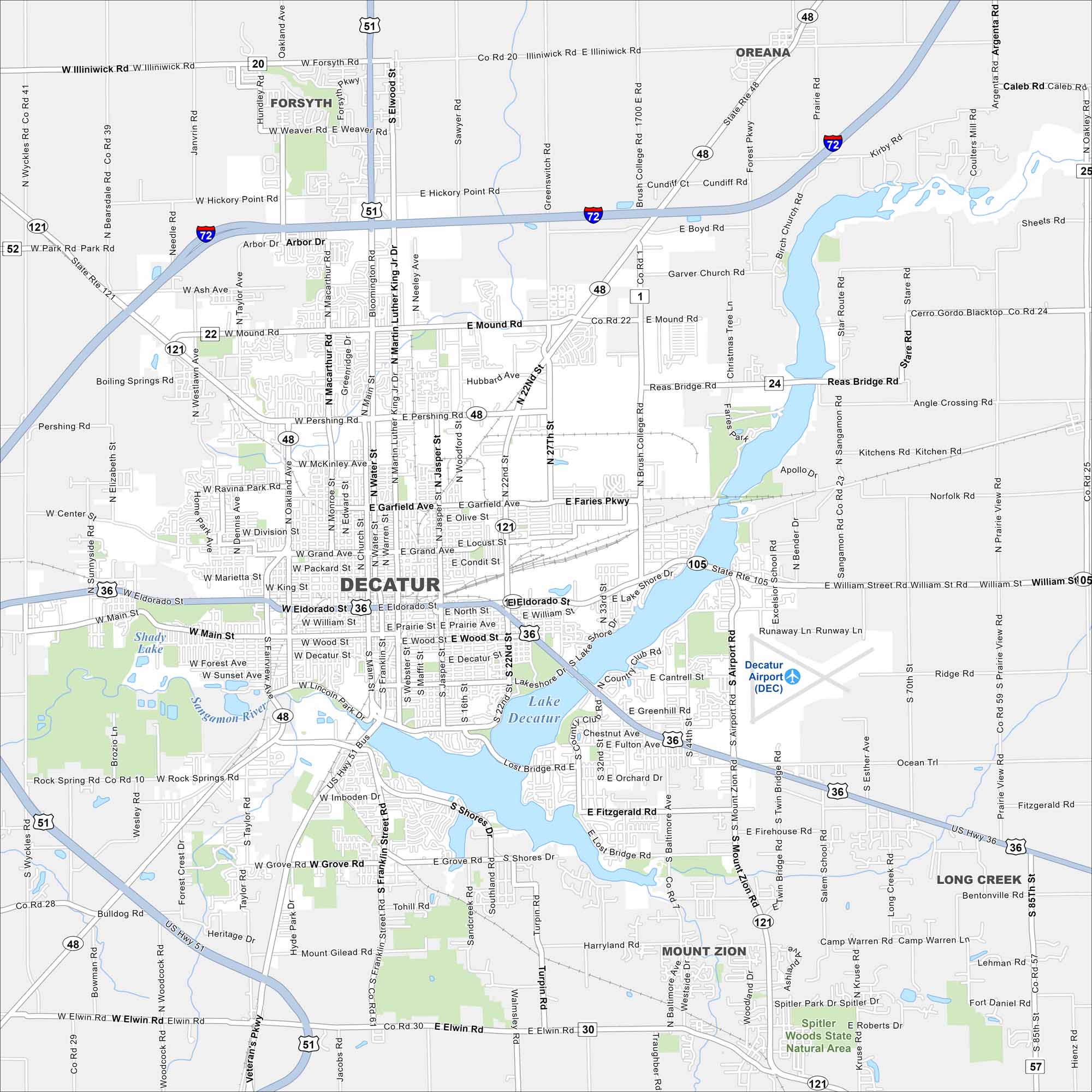
See the roads, highways, and open areas of Decatur on our map. The city stretches across its namesake lake. It’s also known as the “Soybean Capital of the World”.
Illinois State Maps
Get to know Illinois with our state maps


Map Information
On the Map
Interstates/Highways: I-72, US Hwy 51, US Hwy 36, US Hwy 51 Bus, State Rte 121, State Rte 48, State Rte 105 Major Roads: Eldorado St, Pershing Rd, Mound Rd, William St, Main St, Jasper St, 22nd St, Airport Rd, Wyckles Rd, Mount Zion Rd, Franklin St, Brush College Rd, Weaver Rd, Illiniwick Rd, Grove Rd, Elwin Rd, Imboden Rd, Lake Shore Dr, Cantrell St, Taylor Rd Airports: Decatur Airport (DEC) Lakes and Reservoirs: Lake Decatur, Shady Lake Major Rivers: Sangamon River Parks and Preserves: Spitler Woods State Natural Area Nearby Communities: Forsyth, Oreana, Long Creek, Mount ZionIllinois City Maps
Explore Chicago and urban regions of Illinois


