Map of Deerfield, Illinois
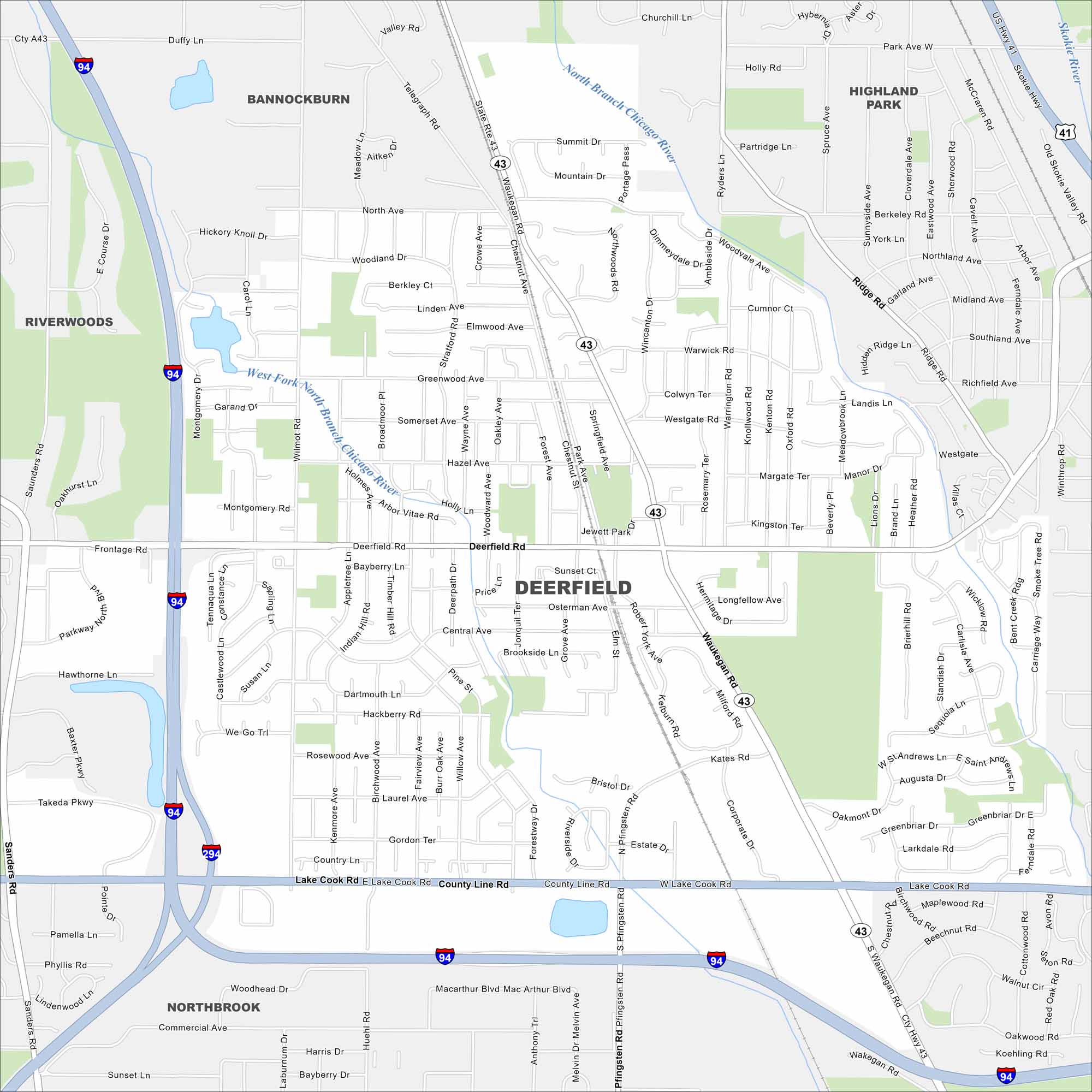
North of Chicago, this community is set near the Des Plaines River. It has quiet neighborhoods with quick access to the city. Our map of Deerfield highlights local roads, highways, and open green areas.
Illinois State Maps
Get to know Illinois with our state maps


Map Information
On the Map
Interstates/Highways: I-94, I-294, US Hwy 41, State Rte 43, State Rte 21 Major Roads: Lake Cook Rd, County Line Rd, Waukegan Rd, Deerfield Rd, Saunders Rd, Pfingsten Rd, Duffy Ln, Greenwood Ave, Central Ave, Kates Rd, Wilmot Rd, North Ave, Tenant Rd, Corporate Dr, Highland Ave, Ridge Rd, Berkeley Rd, Southland Ave, Richfield Ave, Landis Ln Major Rivers: North Branch Chicago River, West Fork North Branch Chicago River Nearby Communities: Bannockburn, Highland Park, Riverwoods, NorthbrookIllinois City Maps
Explore Chicago and urban regions of Illinois


