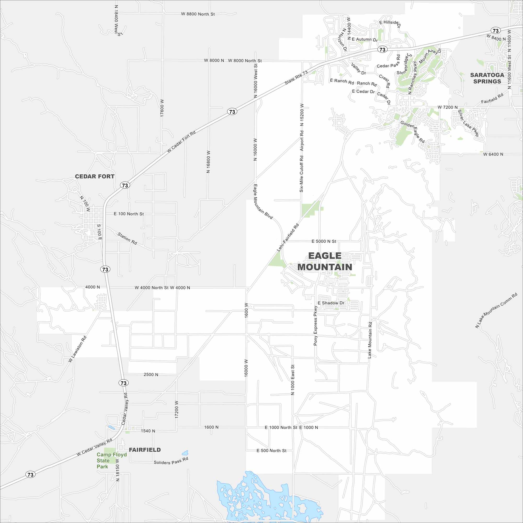
Map of Eagle Mountain, Utah
Explore Eagle Mountain on the edge of Utah County. This region has open desert, foothills, and fast-growing housing communities. Its wide-open setting gives it a very different feel from nearby cities.
Map Information
On the Map
Interstates/Highways: State Rte 73 Major Roads: Eagle Mountain Blvd, Pony Express Pkwy, Ranches Pkwy, Cedar Fort Rd, Airport Rd, Lehi-Fairfield Rd, Six-Mile Cutoff Rd, Silver Lake Pkwy, Lake Mountain Rd, 8000 North St, 4000 North St, 1000 North St, 16000 West St, 1600 West St, 1000 East St, Unity Pass Rd, Golden Eagle Rd, Shadow Dr, Bobby Wren Blvd, Sunset Dr Parks and Preserves: Camp Floyd State Park Nearby Communities: Saratoga Springs, Cedar Fort, FairfieldUtah State Maps
Look through maps of deserts, parks, and cities.


City Maps of Utah
Here is Salt Lake City and Utah’s urban regions.


