Map of East St. Louis, Illinois
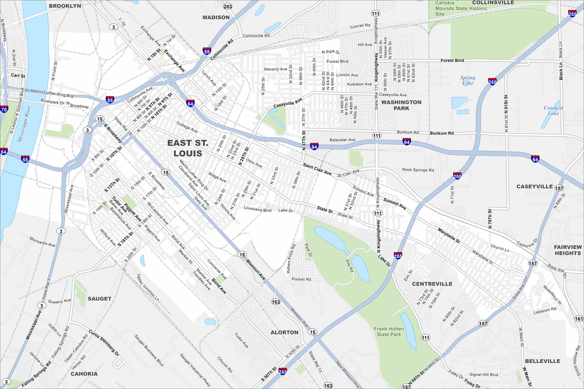
East St. Louis lies right across the Mississippi River from St. Louis. The river dominates the western edge of the map. It includes railways, highways and state parks.
Illinois State Maps
Get to know Illinois with our state maps


Map Information
On the Map
Interstates/Highways: I-55, I-64, I-70, I-255, US Hwy 50, State Rte 3, State Rte 15, State Rte 157, State Rte 161, State Rte 111, State Rte 163, State Rte 203 Major Roads: State St, St. Clair Ave, Collinsville Ave, Broadway, Missouri Ave, Kingshighway, Bunkum Rd, Bond Ave, 19th St, 25th St, 89th St, Main St, Falling Springs Rd, Mousette Ln, Camp Jackson Rd, Sauget Business Blvd, Exchange Ave, Ridge Ave, Lynch Ave, Caseyville Ave Lakes and Reservoirs: Spring Lake, Crooked Lake Major Rivers: Mississippi River Parks and Preserves: Frank Holten State Park, Cahokia Mounds State Historic Site Nearby Communities: Brooklyn, Madison, Washington Park, Caseyville, Fairview Heights, Belleville, Alorton, Centreville, Sauget, CahokiaIllinois City Maps
Explore Chicago and urban regions of Illinois


