Map of Edwardsville, Illinois
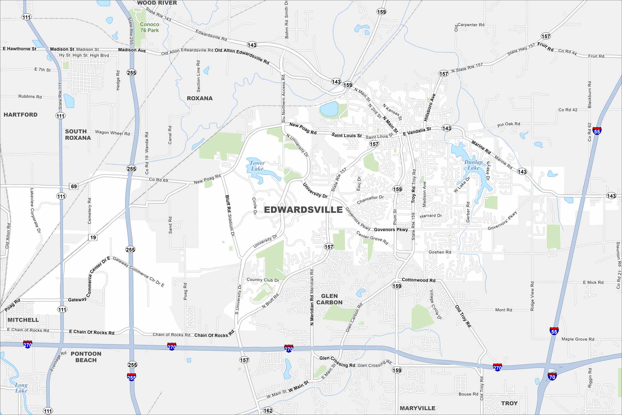
You can find Edwardsville northeast of St. Louis. You’ll notice wide open farmland with lots of parks. It’s ones of the oldest cities in Illinois, with roots tracing back to the early 1800s.
Illinois State Maps
Get to know Illinois with our state maps


Map Information
On the Map
Interstates/Highways: I-55, I-270, I-70, State Rte 157, State Rte 159, State Rte 143, State Rte 111, State Rte 162, State Rte 255 Major Roads: Main St, Governors Pkwy, Center Grove Rd, Goshen Rd, Troy Rd, University Dr, New Poag Rd, Marine Rd, Chain of Rocks Rd, Madison Ave, Vandalia St, St. Louis St, Schwarz St, Plum St, Esic Dr, Meridian Rd, Bluff Rd, Old Alton Edwardsville Rd, Mitchell Ave, Gateway Commerce Ctr Dr Lakes and Reservoirs: Dunlap Lake, Tower Lake, Long Lake Nearby Communities: Wood River, Roxana, South Roxana, Hartford, Mitchell, Pontoon Beach, Glen Carbon, Maryville, TroyIllinois City Maps
Explore Chicago and urban regions of Illinois


