Map of Florissant, Missouri
Florissant sits in north St. Louis County near the Missouri River. Residential neighborhoods spread widely across the map. Its position close to the river valley gives the area a low, broad look.
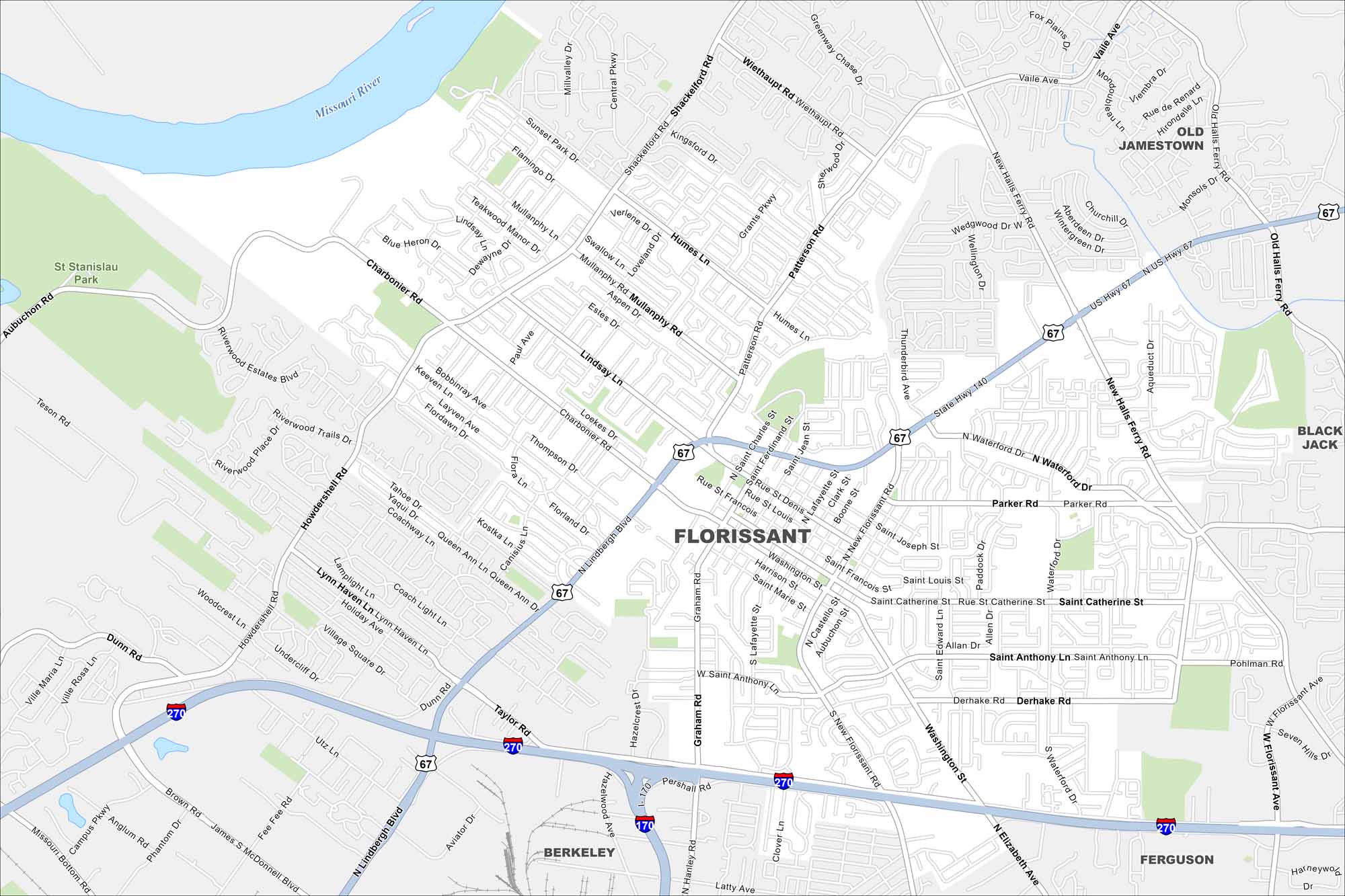
Map Information
On the Map
Interstates/Highways: I-270, I-170, US Hwy 67, State Rte 140 Major Roads: Lindbergh Blvd, New Halls Ferry Rd, Washington St, Shackelford Rd, Mullanphy Rd, Patterson Rd, Saint Charles St, Saint Francois St, Saint Ferdinand St, Saint Louis St, Saint Catherine St, Saint Anthony Ln, Elizabeth Ave, Hanley Rd, Graham Rd, Taylor Rd, Charbonier Rd, Parker Rd, Derhake Rd, Waterford Dr Major Rivers: Missouri River Parks and Preserves: St Stanislau Park Nearby Communities: Old Jamestown, Black Jack, Ferguson, BerkeleyMissouri State Maps
Check out state maps of the Show-Me State.


Missouri City Maps
Here are our city maps for Missouri


