Map of Fox Lake, Illinois
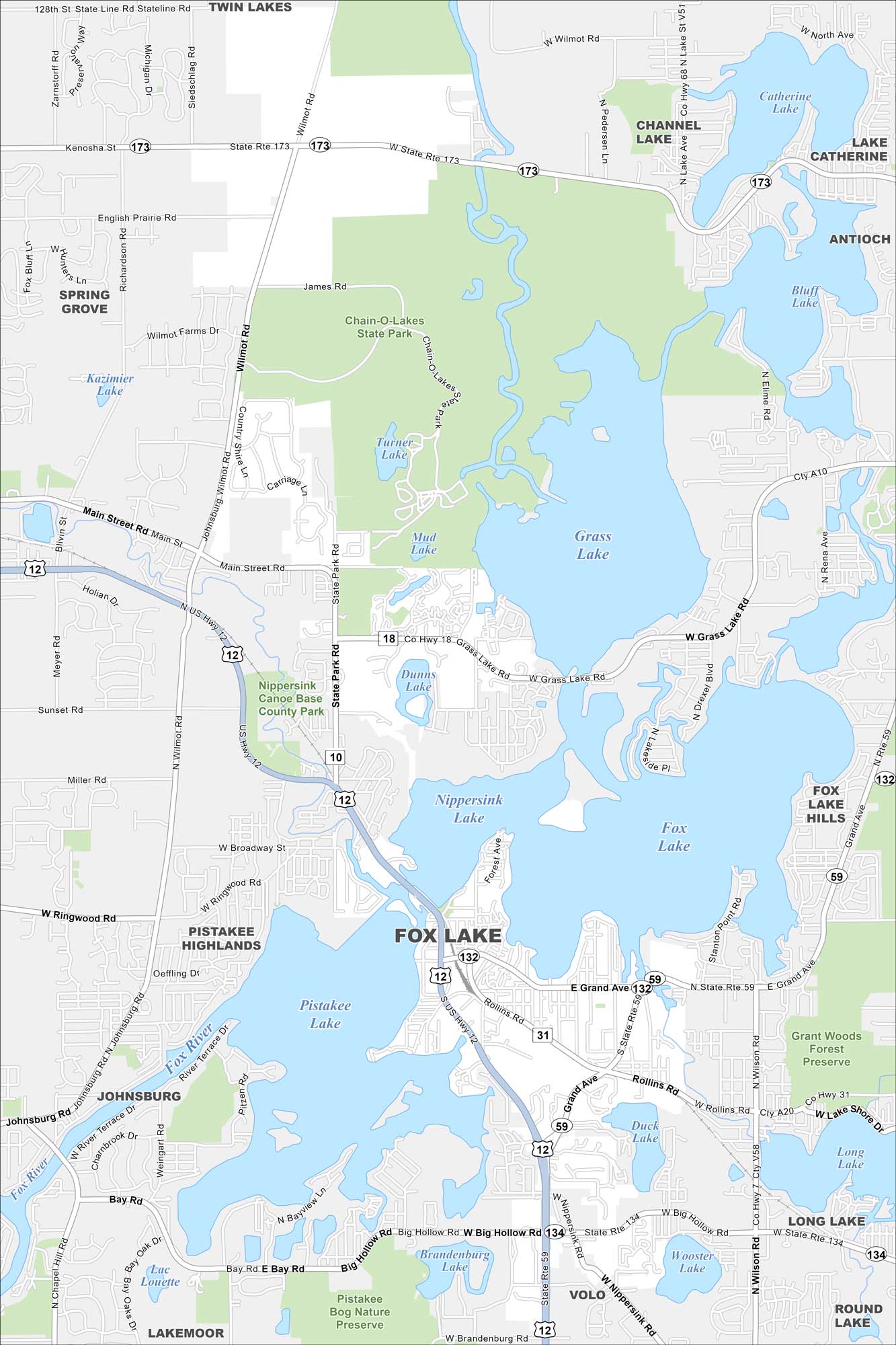
Our map of Fox Lake shows it surrounded by the Chain O’Lakes. Waterways and lakes dominate the landscape. U.S. Route 12 cuts right through, linking it north and south.
Illinois State Maps
Get to know Illinois with our state maps


Map Information
On the Map
Interstates/Highways: US Hwy 12, State Rte 173, State Rte 132, State Rte 59, State Rte 134 Major Roads: Grand Ave, Rollins Rd, Big Hollow Rd, Grass Lake Rd, Main Street Rd, State Park Rd, Wilson Rd, Wilmot Rd, Nippersink Rd, Mullan Rd, Bay Rd, Ringwood Rd, Brandenburg Rd, Washington St, Riverside Dr, Cedar Lake Rd Lakes and Reservoirs: Grass Lake, Fox Lake, Nippersink Lake, Pistakee Lake, Duck Lake, Long Lake, Dunns Lake, Mud Lake, Turner Lake, Bluff Lake, Catherine Lake, Channel Lake, Wooster Lake, Brandenburg Lake, Lac Louette, Kazimier Lake, Stanton Point, Lotus Lake Major Rivers: Fox River Parks and Preserves: Chain-O-Lakes State Park, Grant Woods Forest Preserve, Pistakee Bog Nature Preserve, Nippersink Canoe Base County Park Nearby Communities: Twin Lakes, Spring Grove, Johnsburg, Lakemoor, Volo, Round Lake, Long Lake, Fox Lake Hills, AntiochIllinois City Maps
Explore Chicago and urban regions of Illinois


