Map of Gladstone, Missouri
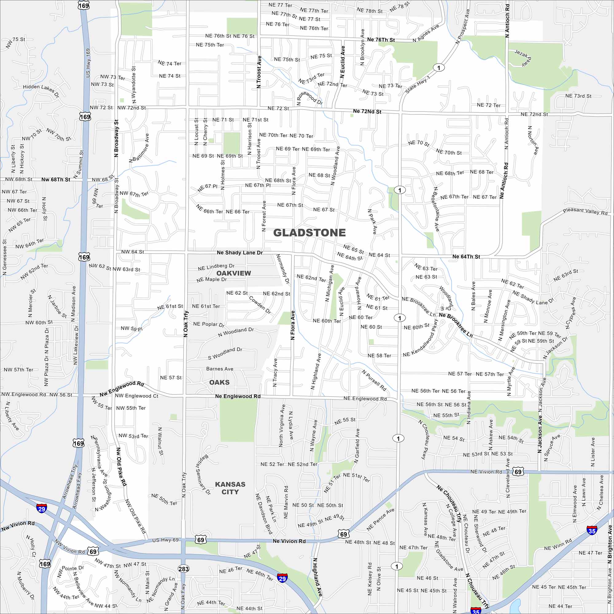
Gladstone, Missouri is a small city in the Kansas City metro. Our map shows its highways, roads, streams and local parks.
Map Information
On the Map
Interstates/Highways: I-29, US Hwy 169, US Hwy 69, State Rte 1, State Rte 283 Major Roads: Oak Trfy, North Oak Trfy, Chouteau Trfy, Vivion Rd, Antioch Rd, Broadway St, 68th St, 72nd St, 64th St, Shady Lane Dr, Englewood Rd, 50th St, 70th St, Flora Ave, Euclid Ave, Park Ave, Brooktree Ln, Kendallwood Pkwy, Indiana Ave, Jackson Ave Nearby Communities: Oakview, Oaks, Kansas CityMissouri State Maps
Check out state maps of the Show-Me State.


Missouri City Maps
Here are our city maps for Missouri


