Map of Glenview, Illinois
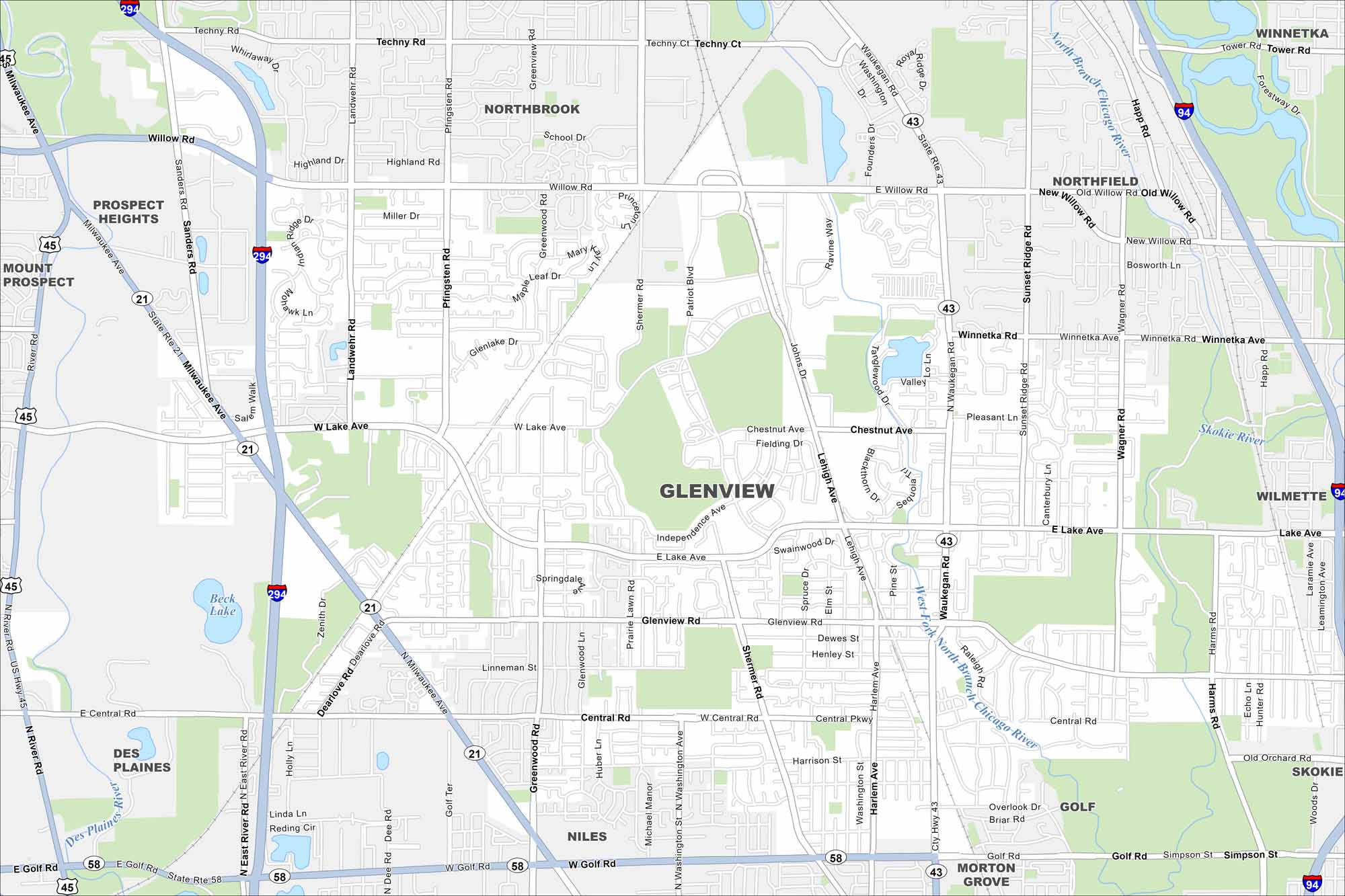
Glenview is just outside Chicago, Illinois. You’ll notice highways, roads, rivers, lakes and green spaces that stretch across the map.
Illinois State Maps
Get to know Illinois with our state maps


Map Information
On the Map
Interstates/Highways: I-294, I-94, US Hwy 45, State Rte 21, State Rte 58, State Rte 43 Major Roads: Milwaukee Ave, Golf Rd, Central Rd, Waukegan Rd, Glenview Rd, Lake Ave, Willow Rd, Greenwood Rd, Shermer Rd, Pfingsten Rd, Sanders Rd, Wagner Rd, Harms Rd, Lehigh Ave, Harlem Ave, Sunset Ridge Rd, Dearlove Rd, Techny Rd, Landwehr Rd Major Rivers: Des Plaines River, West Fork North Branch Chicago River, North Branch Chicago River, Skokie River Nearby Communities: Northbrook, Northfield, Winnetka, Wilmette, Skokie, Golf, Morton Grove, Niles, Des Plaines, Mount Prospect, Prospect HeightsIllinois City Maps
Explore Chicago and urban regions of Illinois


