Map of Goose Creek, South Carolina
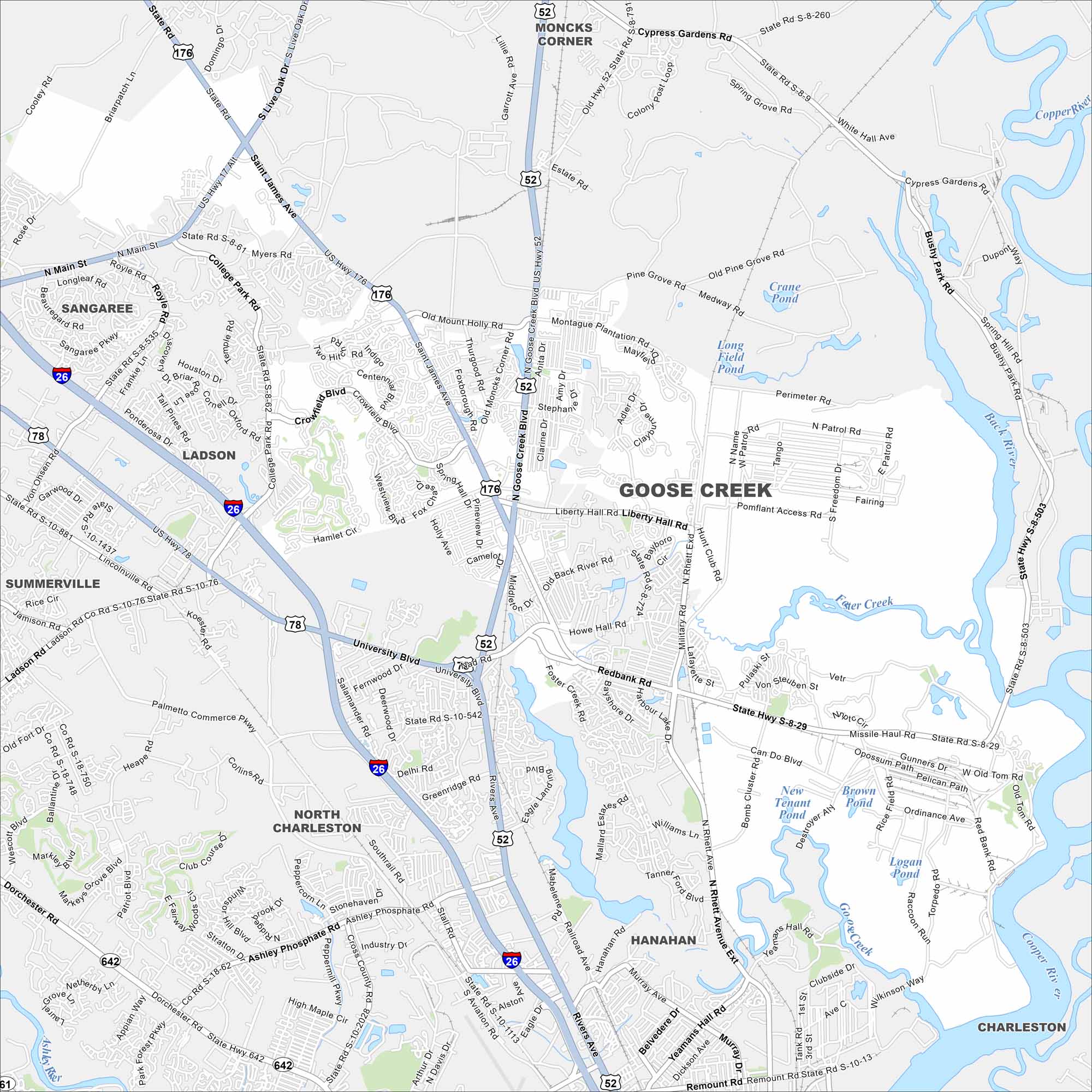
Goose Creek is outside Charleston, with rivers and creeks running nearby. It feels suburban but still manages to stay connected to the larger metro. Waterways and green patches fill the map.
Map Information
On the Map
Interstates/Highways: I-26, US Hwy 52, US Hwy 176, US Hwy 78, State Rte 642, State Rte 61 Major Roads: University Blvd, Goose Creek Blvd, St James Ave, Liberty Hall Rd, College Park Rd, Redbank Rd, Montague Plantation Rd, Old Moncks Corner Rd, Old Hwy 52, Myers Rd, Crowfield Blvd, Foster Creek Rd, Henry Brown Blvd, Bushy Park Rd, Cypress Gardens Rd, Yeamans Hall Rd, Belvedere Dr, Murray Ave, Nad Rd, Snake Rd Lakes and Reservoirs: Crane Pond, Long Field Pond, Medway Pond, New Tenant Pond, Brown Pond, Logan Pond, Raccoon Pond Major Rivers: Back River, Cooper River, Foster Creek, Ashley River Nearby Communities: Moncks Corner, Sangaree, Ladson, Summerville, North Charleston, Hanahan, CharlestonSouth Carolina State Maps
Explore maps across the Palmetto State.


City Maps of South Carolina
Find our maps of Charleston and South Carolina cities here


