Map of Greenville, South Carolina
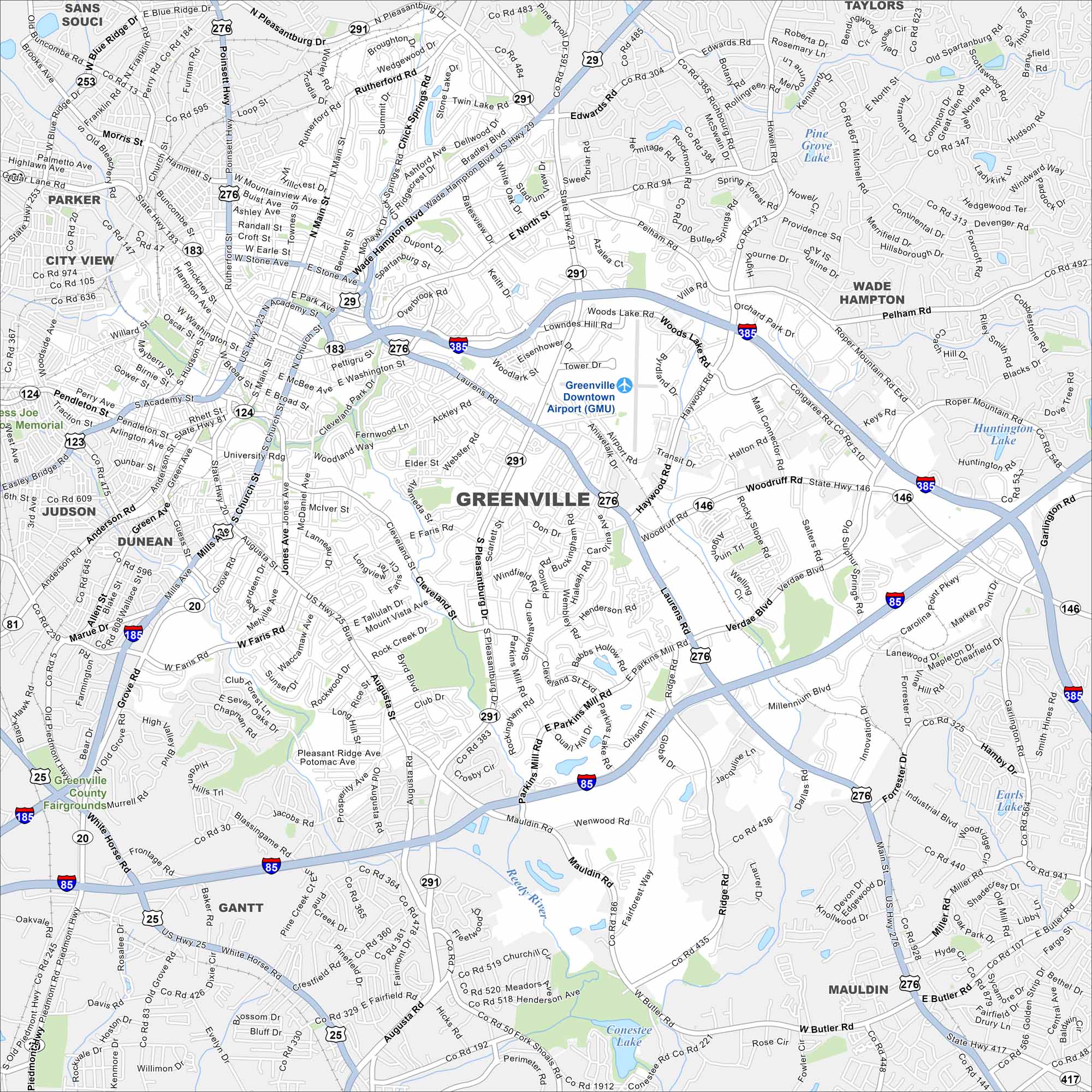
Check out our map of Greenville in the foothills of the Blue Ridge Mountains. The Reedy River cuts through downtown. Highways link it to Atlanta and Charlotte.
Map Information
On the Map
Interstates/Highways: I-385, I-85, I-185, US Hwy 276, US Hwy 29, US Hwy 25, State Rte 291, State Rte 183, State Rte 146, State Rte 124, State Rte 20 Major Roads: Wade Hampton Blvd, Woodruff Rd, Laurens Rd, Pleasantburg Dr, Haywood Rd, Academy St, Church St, Poinsett Hwy, White Horse Rd, Augusta St, Mauldin Rd, Stone Ave, Washington St, Buncombe St, Parkins Mill Rd, Millennium Blvd, Roper Mountain Rd, Verdae Blvd, Pelham Rd, Miller Rd Airports: Greenville Downtown Airport (GMU) Lakes and Reservoirs: Pine Grove Lake, Conestee Lake, Earls Lake, Huntington Lake, Woods Lake Major Rivers: Reedy River Nearby Communities: Sans Souci, Taylors, Wade Hampton, Parker, City View, Judson, Dunean, Gantt, MauldinSouth Carolina State Maps
Explore maps across the Palmetto State.


City Maps of South Carolina
Find our maps of Charleston and South Carolina cities here


