Map of Hampton, Virginia
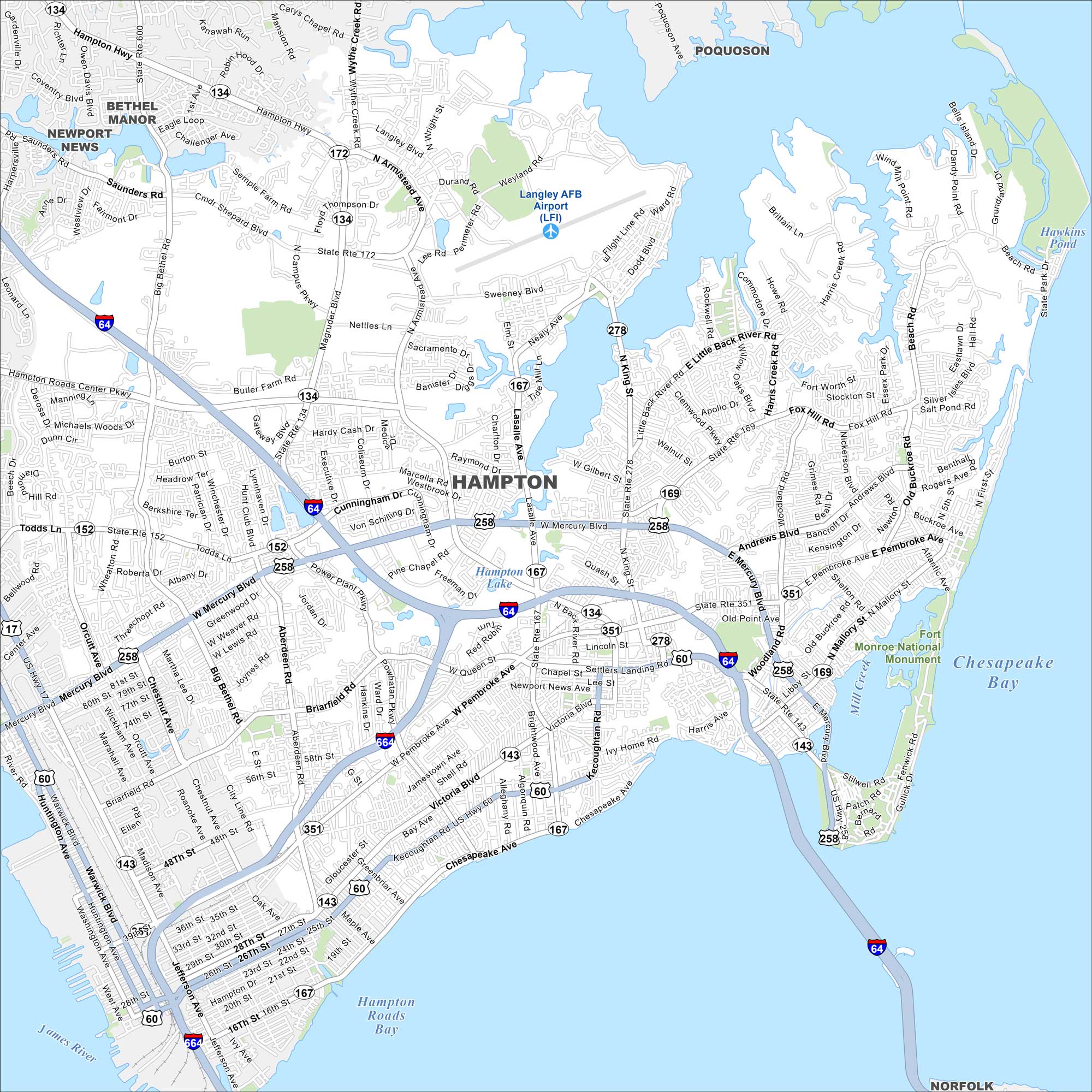
Our map shows Hampton, which is on the Virginia Peninsula. It’s surrounded by the Chesapeake Bay and Hampton Roads. You’ll find highways, streets, lakes and much more on our map.
Map Information
On the Map
Interstates/Highways: I-64, I-664, US Hwy 258, US Hwy 60, State Rte 134, State Rte 172, State Rte 278, State Rte 143, State Rte 167, State Rte 169, State Rte 351 Major Roads: Mercury Blvd, Pembroke Ave, Victoria Blvd, Armistead Ave, King St, Magruder Blvd, LaSalle Ave, Wythe Creek Rd, Woodland Rd, Cunningham Dr, Kecoughtan Ave, Settlers Landing Rd, Mercury Blvd, Commander Shepard Blvd, Power Plant Pkwy, Aberdeen Rd, Big Bethel Rd, Coliseum Dr, Main St, Todds Ln Airports: Langley AFB Airport (LFI) Lakes and Reservoirs: Hampton Lake, Hampton Roads Bay, Chesapeake Bay Major Rivers: James River Parks and Preserves: Fort Monroe National Monument Nearby Communities: Bethel Manor, Newport News, Poquoson, NorfolkVirginia State Maps
Spanning coasts and mountains, here are our maps of Virginia.


City Maps of Virginia
Traverse Virginia using our city maps


