Map of Herriman, Utah
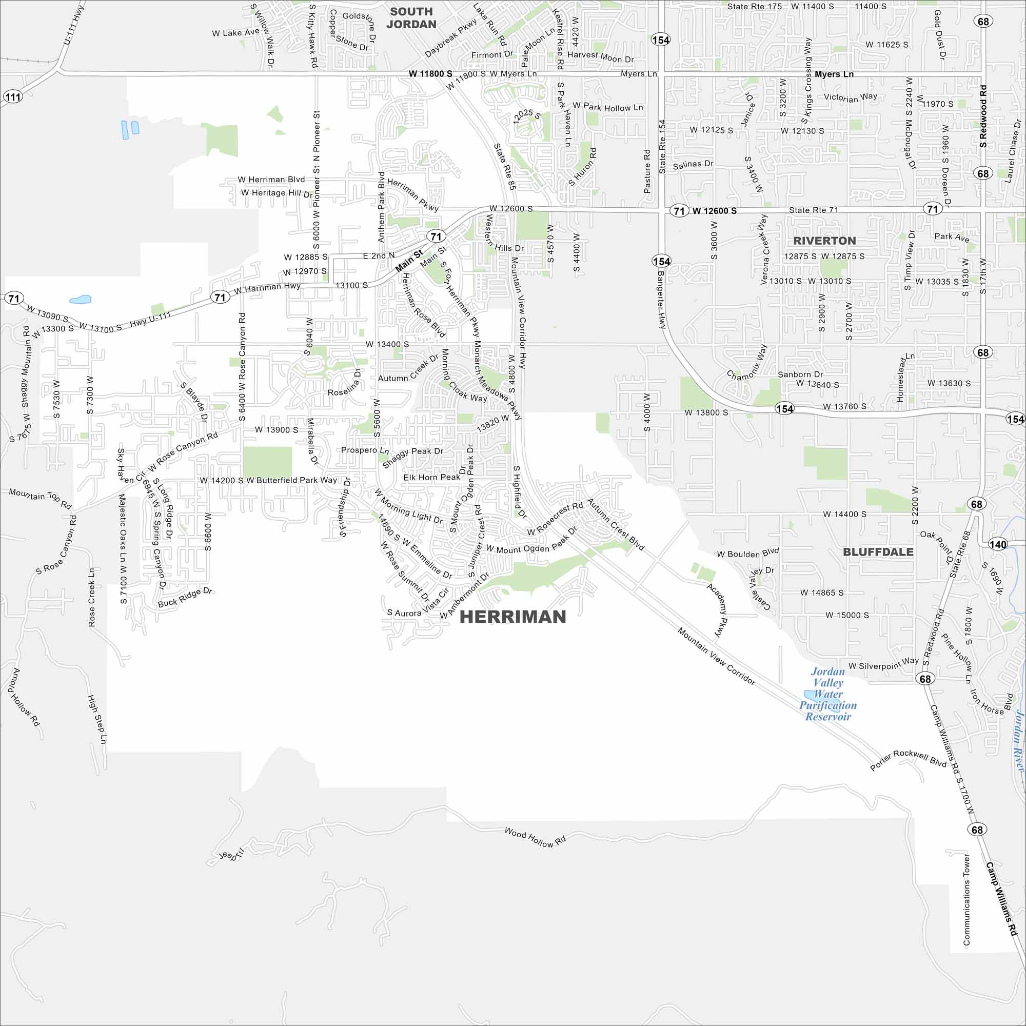
Check out our map of Herriman at the southwestern edge of the Salt Lake Valley. It backs up against the Oquirrh Mountains. City growth spreads toward the valley floor.
Map Information
On the Map
Interstates/Highways: State Rte 85, State Rte 154, State Rte 71, State Rte 111, State Rte 68, State Rte 140, State Rte 175 Major Roads: Mountain View Corridor, Main St, Bangerter Hwy, Herriman Hwy, Redwood Rd, 12600 South St, 11800 South St, 13400 South St, 13100 South St, 6000 West St, 5600 West St, 4000 West St, Rose Canyon Rd, Butterfield Park Way, Mirabella Dr, Anthem Park Pkwy, Friends Rd, Herriman Rose Blvd, Mount Ogden Peak Dr, Autumn Crest Blvd Lakes and Reservoirs: Jordan Valley Water Purification Reservoir Major Rivers: Jordan River Nearby Communities: South Jordan, Riverton, BluffdaleUtah State Maps
Look through maps of deserts, parks, and cities.


City Maps of Utah
Here is Salt Lake City and Utah’s urban regions.


