Map of Hoffman Estates, Illinois
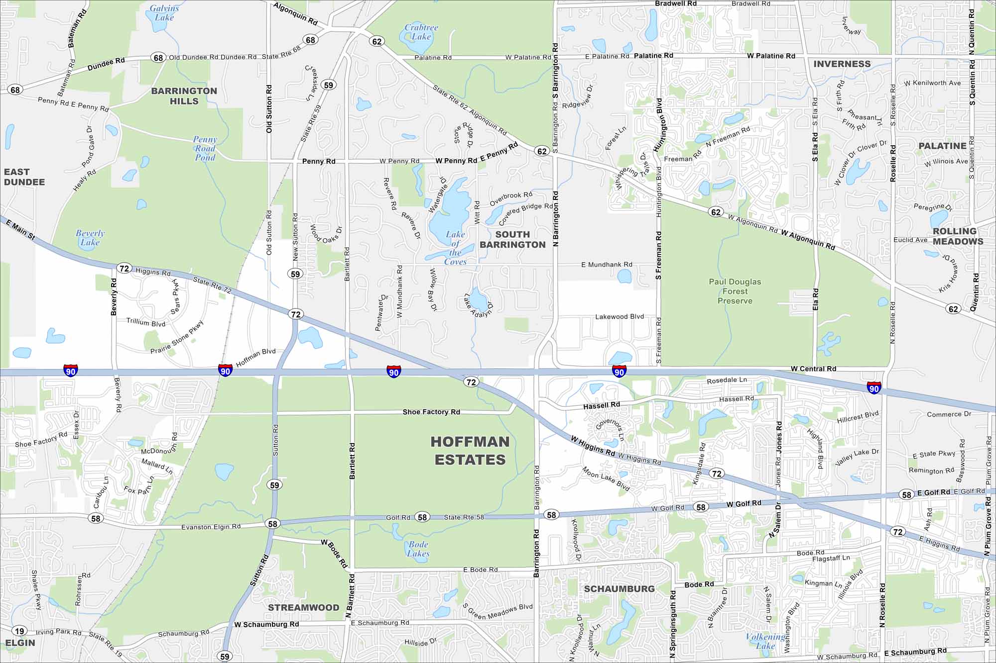
Our map of Hoffman Estates shows neighborhoods stretching along I-90 northwest of Chicago. Parks and forest preserves stand out quite a lot. It’s part of the larger Chicago metro.
Illinois State Maps
Get to know Illinois with our state maps


Map Information
On the Map
Interstates/Highways: I-90, State Rte 68, State Rte 62, State Rte 59, State Rte 72, State Rte 58, State Rte 19 Major Roads: Higgins Rd, Golf Rd, Algonquin Rd, Palatine Rd, Sutton Rd, Barrington Rd, Roselle Rd, Central Rd, Penny Rd, Shoe Factory Rd, Bartlett Rd, Freeman Rd, Huntington Blvd, Mundhank Rd, Bode Rd, Schaumburg Rd, Illinois Ave, Quentin Rd, Ela Rd, Hoffman Blvd Lakes and Reservoirs: Galvins Lake, Crabtree Lake, Penny Road Pond, Beverly Lake, Lake of the Coves, Lake Adalyn, Bode Lakes, Volkening Lake Parks and Preserves: Paul Douglas Forest Preserve Nearby Communities: Barrington Hills, East Dundee, South Barrington, Inverness, Palatine, Rolling Meadows, Schaumburg, Streamwood, ElginIllinois City Maps
Explore Chicago and urban regions of Illinois


