Map of James Island, South Carolina
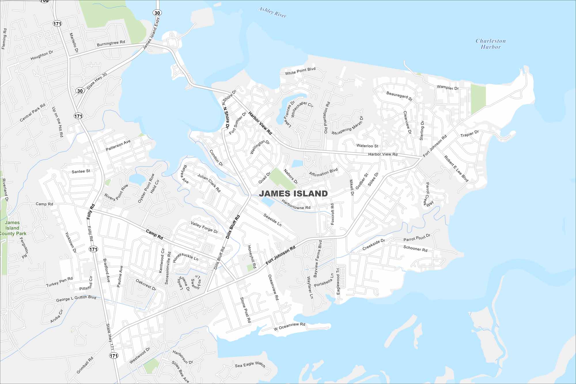
James Island sits between Charleston Harbor and Folly Beach. This map shows marshes and tidal creeks occupying across the island. Residential areas fill the higher ground.
Map Information
On the Map
Interstates/Highways: State Rte 30, State Rte 171 Major Roads: Folly Rd, Fort Johnson Rd, Harbor View Rd, Camp Rd, Dills Bluff Rd, Riverland Dr, Central Park Rd, Shore Dr, Affirmation Blvd, Quail Dr, Nabors Dr, Mikell Dr, Stiles Dr, Oceanview Rd, Grimball Rd, Secessionville Rd, Stone Post Rd, Seaside Ln, Lighthouse Blvd, Maybank Hwy Lakes and Reservoirs: Charleston Harbor Major Rivers: Ashley River, Stono River Parks and Preserves: James Island County ParkSouth Carolina State Maps
Explore maps across the Palmetto State.


City Maps of South Carolina
Find our maps of Charleston and South Carolina cities here


