Map of Jefferson City, Missouri
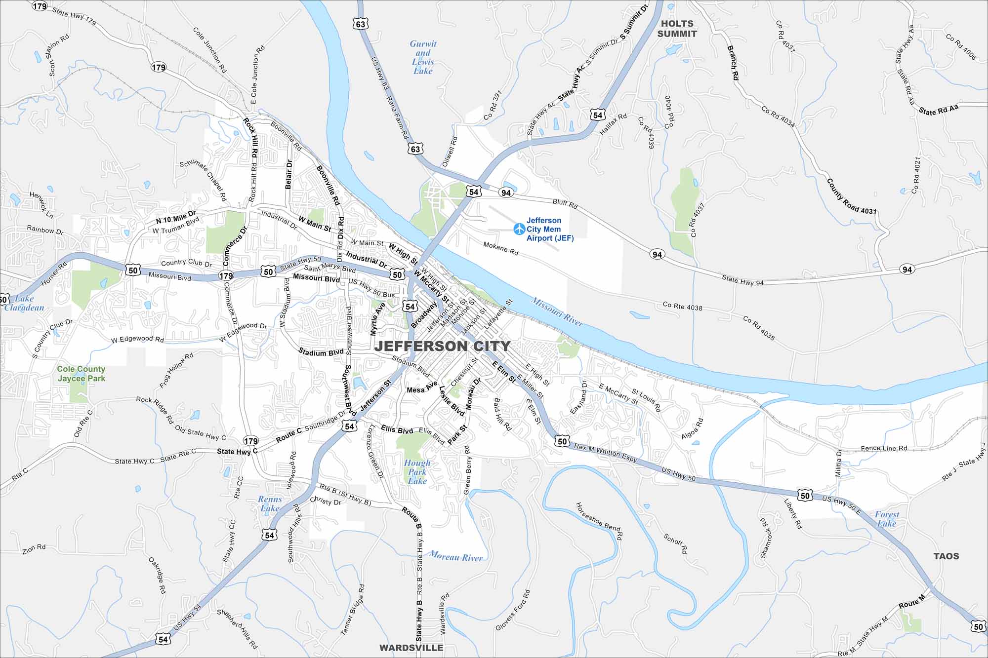
Our map of Jefferson City highlights its spot on the Missouri River. The state capitol stands out near the riverfront. Hills and bluffs rise just beyond downtown.
Map Information
On the Map
Interstates/Highways: US Hwy 54, US Hwy 50, US Hwy 63, State Rte 94, State Rte 179 Major Roads: Stadium Blvd, Missouri Blvd, Main St, High St, McCarty St, Jefferson St, Broadway, Ellis Blvd, Edgewood Rd, Southridge Dr, Truman Blvd, Dix Rd, Ten Mile Dr, Country Club Dr, Industrial Dr, Saint Marys Blvd, Myrtle Ave, Southwest Blvd, Miller St, Chestnut St Airports: Jefferson City Mem Airport (JEF) Lakes and Reservoirs: Gurwit and Lewis Lake, Hough Park Lake, Forest Lake, Horseshoe Bend, Renns Lake Major Rivers: Missouri River, Moreau River Parks and Preserves: Cole County Jaycee Park Nearby Communities: Holts Summit, Wardsville, TaosMissouri State Maps
Check out state maps of the Show-Me State.


Missouri City Maps
Here are our city maps for Missouri


