Map of Joliet, Illinois
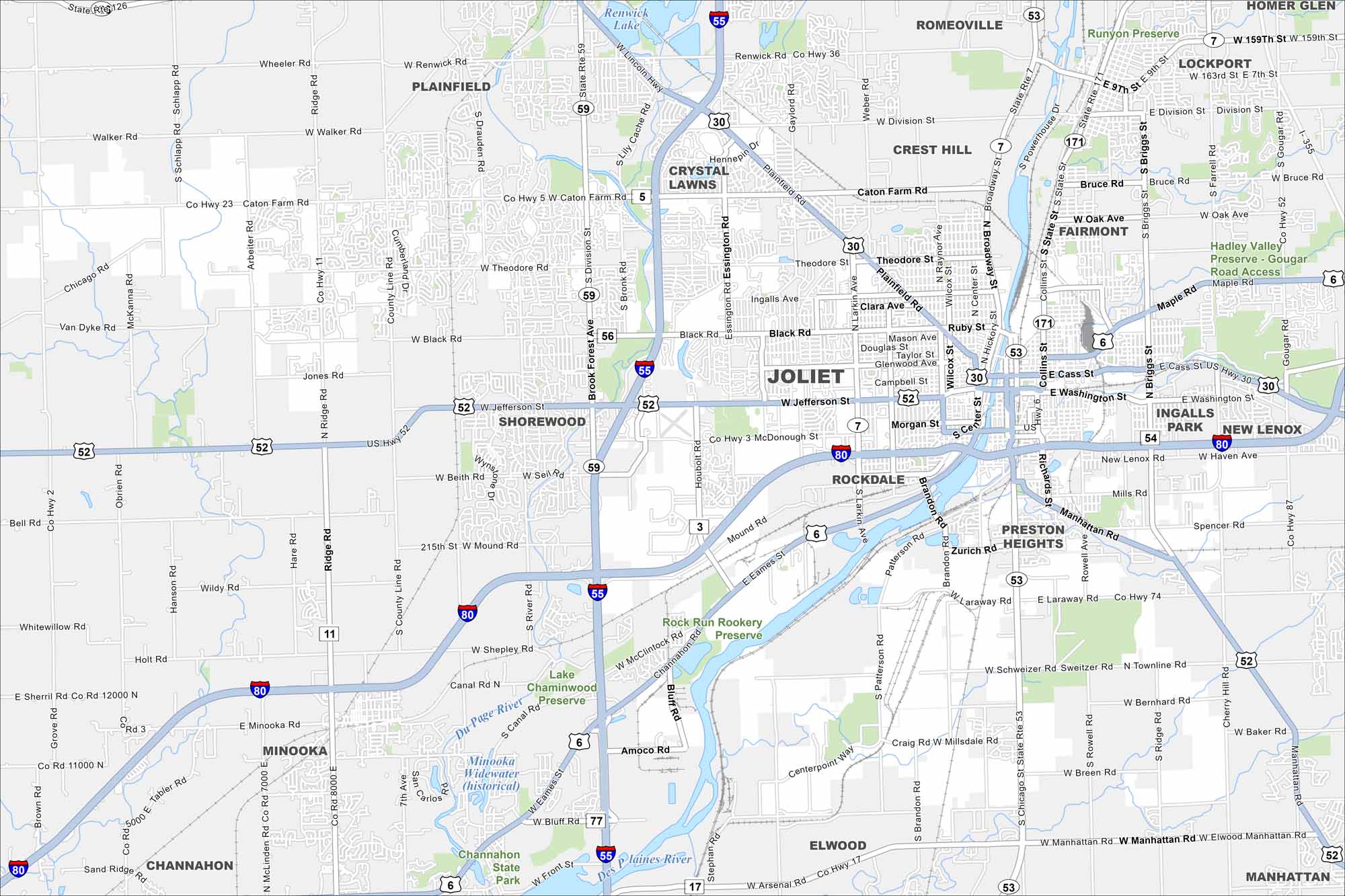
Joliet is on the Des Plaines River southwest of Chicago. This map shows rail lines, highways, and canals crossing the city. Old industrial areas mix with new neighborhoods.
Illinois State Maps
Get to know Illinois with our state maps


Map Information
On the Map
Interstates/Highways: I-55, I-80, US Hwy 30, US Hwy 52, State Rte 59, State Rte 7, State Rte 171, State Rte 53, State Rte 126 Major Roads: Jefferson St, Cass St, Washington St, Theodore St, Black Rd, Caton Farm Rd, Division St, Larkin Ave, Broadway St, Collins St, Richards St, Brandon Rd, Manhattan Rd, Mills Rd, Laraway Rd, Houbolt Rd, Essington Rd, Weber Rd, Renwick Rd, Wheeler Rd Lakes and Reservoirs: Renwick Lake, Lake Chaminwood Major Rivers: Du Page River, Des Plaines River Parks and Preserves: Runyon Preserve, Hadley Valley Preserve – Gougar Road Access, Rock Run Rookery Preserve, Chaminwood Preserve, Channahon State Park Nearby Communities: Plainfield, Romeoville, Crest Hill, Fairmont, Lockport, Homer Glen, New Lenox, Ingalls Park, Preston Heights, Rockdale, Crystal Lawns, Shorewood, Minooka, Channahon, Elwood, ManhattanIllinois City Maps
Explore Chicago and urban regions of Illinois


