Map of Williamsburg, Virginia
This Williamsburg map highlights the historic colonial district. It’s a living history destination with cobblestone streets and well-preserved buildings.
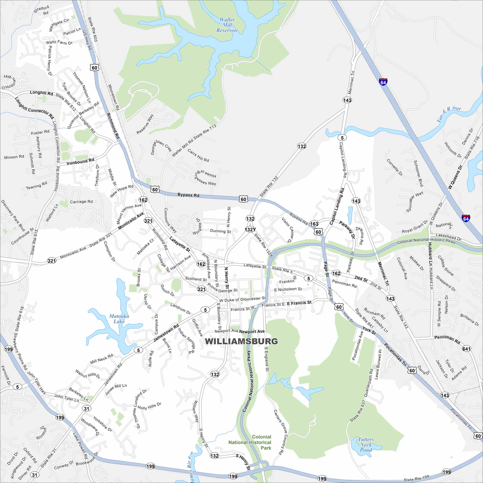
Map Information
On the Map
Interstates/Highways: I-64, US Hwy 60, State Rte 5, State Rte 31, State Rte 132, State Rte 143, State Rte 162, State Rte 199, State Rte 321 Major Roads: Richmond Rd, Bypass Rd, Monticello Ave, Jamestown Rd, Lafayette St, Duke of Gloucester St, Francis St, York St, Page St, Capitol Landing Rd, Merrimac Trail, Ironbound Rd, Longhill Rd, Henry St, England St, Brookwood Dr, Penniman Rd, Hubbard Ln, Pocahontas Trail, Quarterpath Rd Lakes and Reservoirs: Matoaka Lake, Waller Mill Reservoir, Tutters Neck Pond Major Rivers: James River, York River Parks and Preserves: Colonial National Historical ParkVirginia State Maps
Spanning coasts and mountains, here are our maps of Virginia.


City Maps of Virginia
Traverse Virginia using our city maps


