Map of Kankakee, Illinois
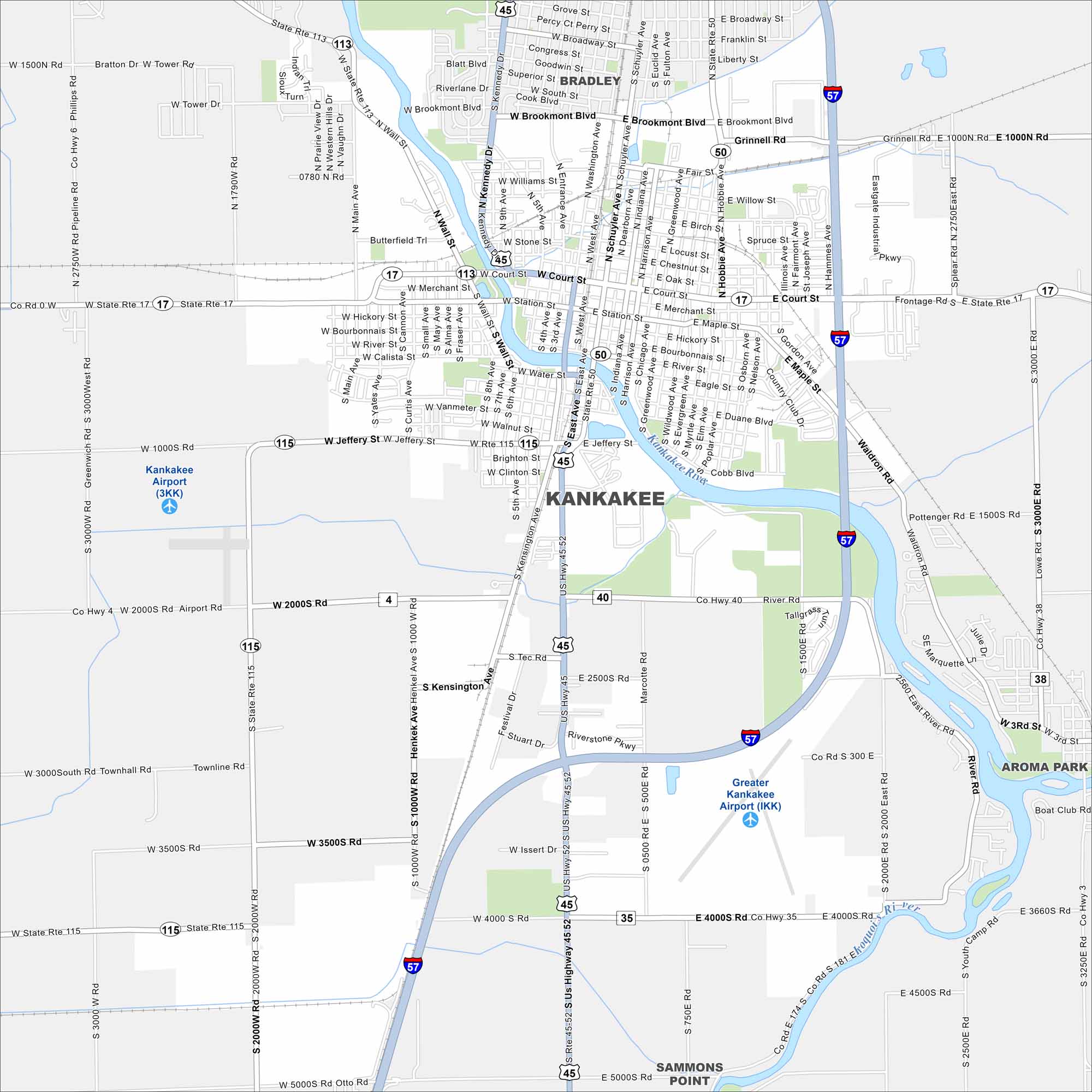
Kankakee is built on the Kankakee River. Our map shows the river winding straight through the city. Parks and bridges line its banks.
Illinois State Maps
Get to know Illinois with our state maps


Map Information
On the Map
Interstates/Highways: I-57, US Hwy 45, US Hwy 52, State Rte 113, State Rte 115, State Rte 17, State Rte 50 Major Roads: Court St, Station St, Water St, Jeffery St, River St, Brookmont Blvd, Kennedy Dr, Schuyler Ave, Main Ave, Wall St, Entrance Ave, Washington Ave, Indiana Ave, Harrison Ave, Greenwood Ave, Fairmont Ave, Hobbie Ave, 2000S Rd, 4000S Rd, Lowe Rd Airports: Kankakee Airport (3KK), Greater Kankakee Airport (IKK) Major Rivers: Kankakee River, Iroquois River Nearby Communities: Bradley, Aroma Park, Sammons PointIllinois City Maps
Explore Chicago and urban regions of Illinois


