Map of Kansas City, Missouri
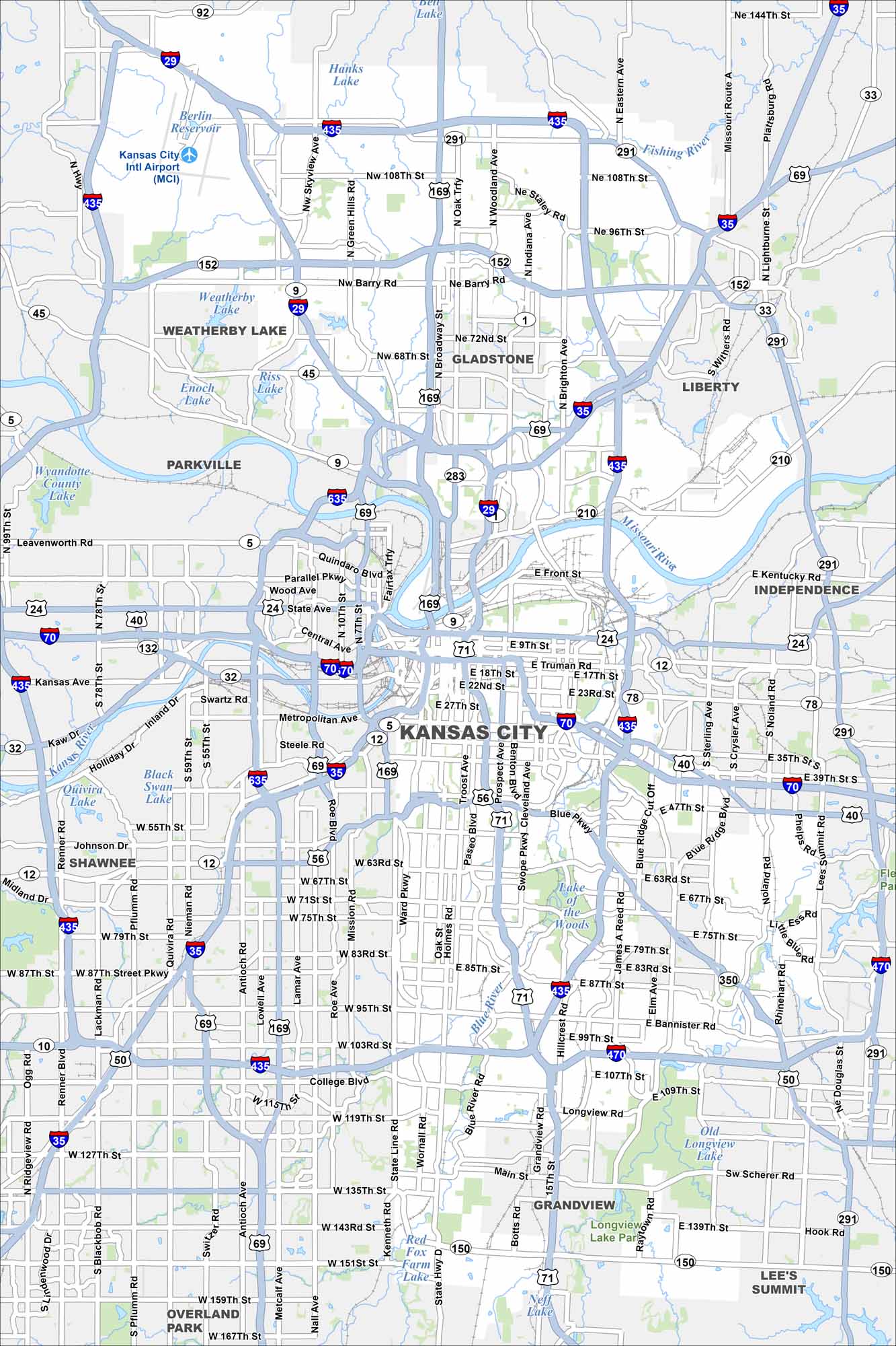
Kansas City spreads wide across the Missouri side. Our map highlights the Missouri River bending around downtown. Boulevards and parks stretch south through the city.
Map Information
On the Map
Interstates/Highways: I-29, I-35, I-70, I-435, I-470, I-635, US Hwy 24, US Hwy 40, US Hwy 50, US Hwy 56, US Hwy 69, US Hwy 71, US Hwy 150, US Hwy 169, State Rte 1, State Rte 5, State Rte 9, State Rte 12, State Rte 32, State Rte 33, State Rte 35, State Rte 45, State Rte 78, State Rte 92, State Rte 152, State Rte 210, State Rte 283, State Rte 291, State Rte 350 Major Roads: Main St, Broadway Blvd, Troost Ave, Paseo Blvd, Prospect Ave, State Line Rd, Wornall Rd, Holmes Rd, Metcalf Ave, Antioch Rd, Quivira Rd, Noland Rd, Barry Rd, 63rd St, 75th St, 87th St, 103rd St, College Blvd, 135th St, 151st St Airports: Kansas City Intl Airport (MCI) Lakes and Reservoirs: Weatherby Lake, Berlin Reservoir, Hanks Lake, Riss Lake, Enoch Lake, Wyandotte County Lake, Lake of the Woods, Longview Lake, Old Longview Lake, Red Fox Farm Lake Major Rivers: Missouri River, Fishing River Parks and Preserves: Longview Lake Park Nearby Communities: Gladstone, Liberty, Independence, Lee’s Summit, Grandview, Raytown, Overland Park, Shawnee, Parkville, Weatherby Lake Neighborhoods: Downtown Kansas CityMissouri State Maps
Check out state maps of the Show-Me State.


Missouri City Maps
Here are our city maps for Missouri


