Map of Lee’s Summit, Missouri
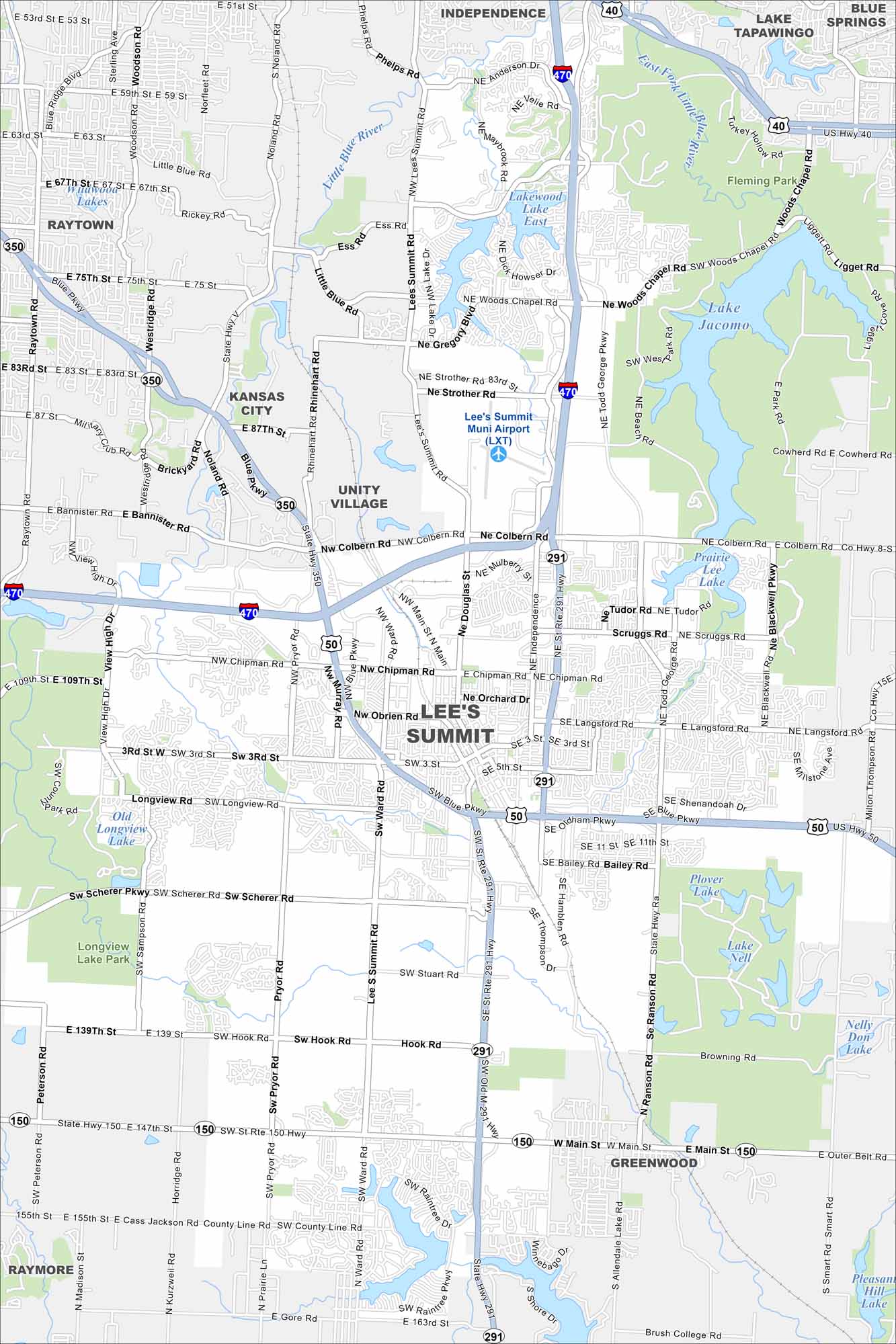
Our map of Lee’s Summit highlights lakes scattered across the city. Neighborhoods branch out in every direction. The setting mixes open land with residential growth.
Map Information
On the Map
Interstates/Highways: I-470, US Hwy 50, State Rte 150, State Rte 291 Major Roads: Main St, Lee’s Summit Rd, Colbern Rd, Chipman Rd, Douglas St, Ward Rd, Blue Pkwy, Pryor Rd, Scruggs Rd, Langsford Rd, Oldham Pkwy, Bailey Rd, Hook Rd, Todd George Rd, Gregory Blvd, Strother Rd, Orchard Dr, Obrien Rd, Tudor Rd, Sampson Rd Airports: Lee’s Summit Muni Airport (LXT) Lakes and Reservoirs: Longview Lake, Old Longview Lake, Lakewood Lake East, Lake Jacomo, Prairie Lee Lake, Lake Nell, Plover Lake, Nelly Don Lake, Raintree Lake Major Rivers: Little Blue River Parks and Preserves: Longview Lake Park Nearby Communities: Kansas City, Independence, Blue Springs, Raytown, Unity Village, Greenwood, RaymoreMissouri State Maps
Check out state maps of the Show-Me State.


Missouri City Maps
Here are our city maps for Missouri


