Map of Winchester, Virginia
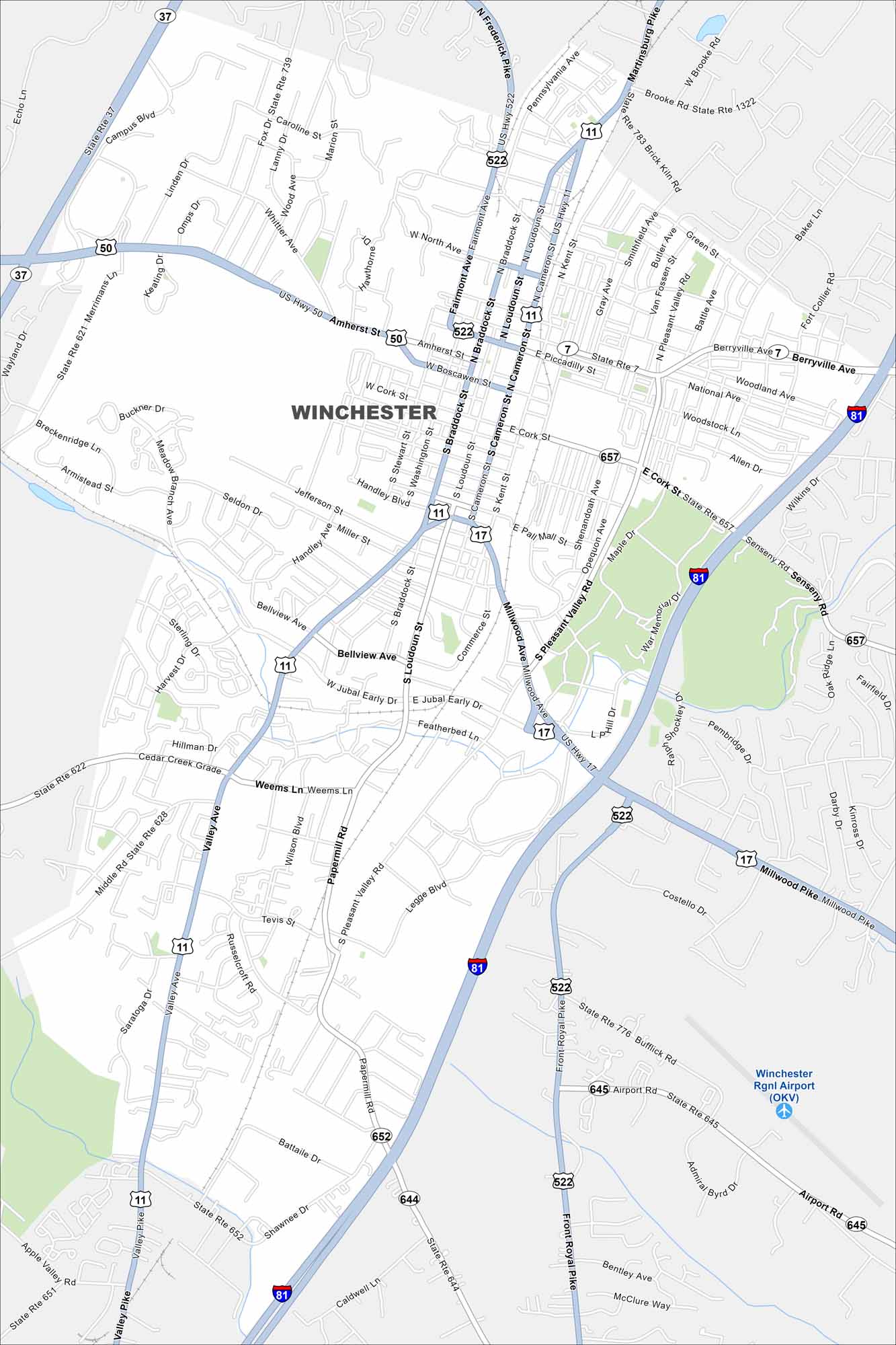
Take a look at our map of Winchester, Virginia. It highlights the downtown area and highways like U.S. 11 and I-81. You’ll also find Winchester Regional Airport in the southeast corner.
Map Information
On the Map
Interstates/Highways: I-81, US Hwy 11, US Hwy 17, US Hwy 50, US Hwy 522, State Rte 7, State Rte 37 Major Roads: Millwood Ave, Amherst St, Valley Ave, Pleasant Valley Rd, Braddock St, Loudoun St, Cameron St, Kent St, Cork St, Boscawen St, Piccadilly St, Jubal Early Dr, Weems Ln, Papermill Rd, Senseny Rd, Berryville Ave, Martinsburg Pike, Frederick Pike, Front Royal Pike, Airport Rd Airports: Winchester Rgnl Airport (OKV)Virginia State Maps
Spanning coasts and mountains, here are our maps of Virginia.


City Maps of Virginia
Traverse Virginia using our city maps


