Map of Liberty, Missouri
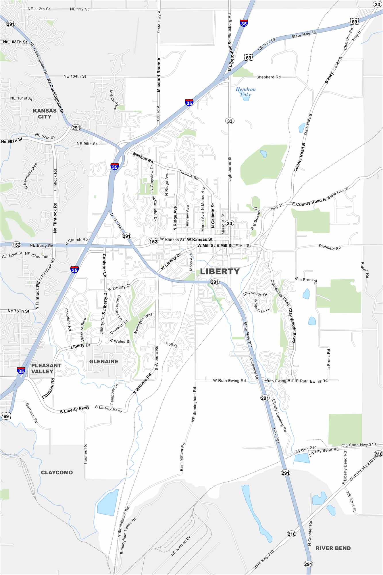
Liberty lies just northeast of Kansas City. The map shows its streets at the center. Surrounding it, neighborhoods fan outward into open land.
Map Information
On the Map
Interstates/Highways: I-35, US Hwy 69, State Rte 33, State Rte 152, State Rte 210, State Rte 291 Major Roads: Kansas St, Mill St, Liberty Dr, Liberty Pkwy, Ruth Ewing Rd, Withers Rd, Flintlock Rd, Lightburne St, Church Rd, Nashua Rd, Ridge Ave, Morse Ave, Gallatin St, Clay Woods Pkwy, Southview Dr, Old Hwy 210, Blue Jay Dr, Birmingham Rd, Hughes Rd, Garrison Rd Lakes and Reservoirs: Hendron Lake Nearby Communities: Kansas City, Glenaire, Pleasant Valley, Claycomo, River BendMissouri State Maps
Check out state maps of the Show-Me State.


Missouri City Maps
Here are our city maps for Missouri


