Map of Lombard, Illinois
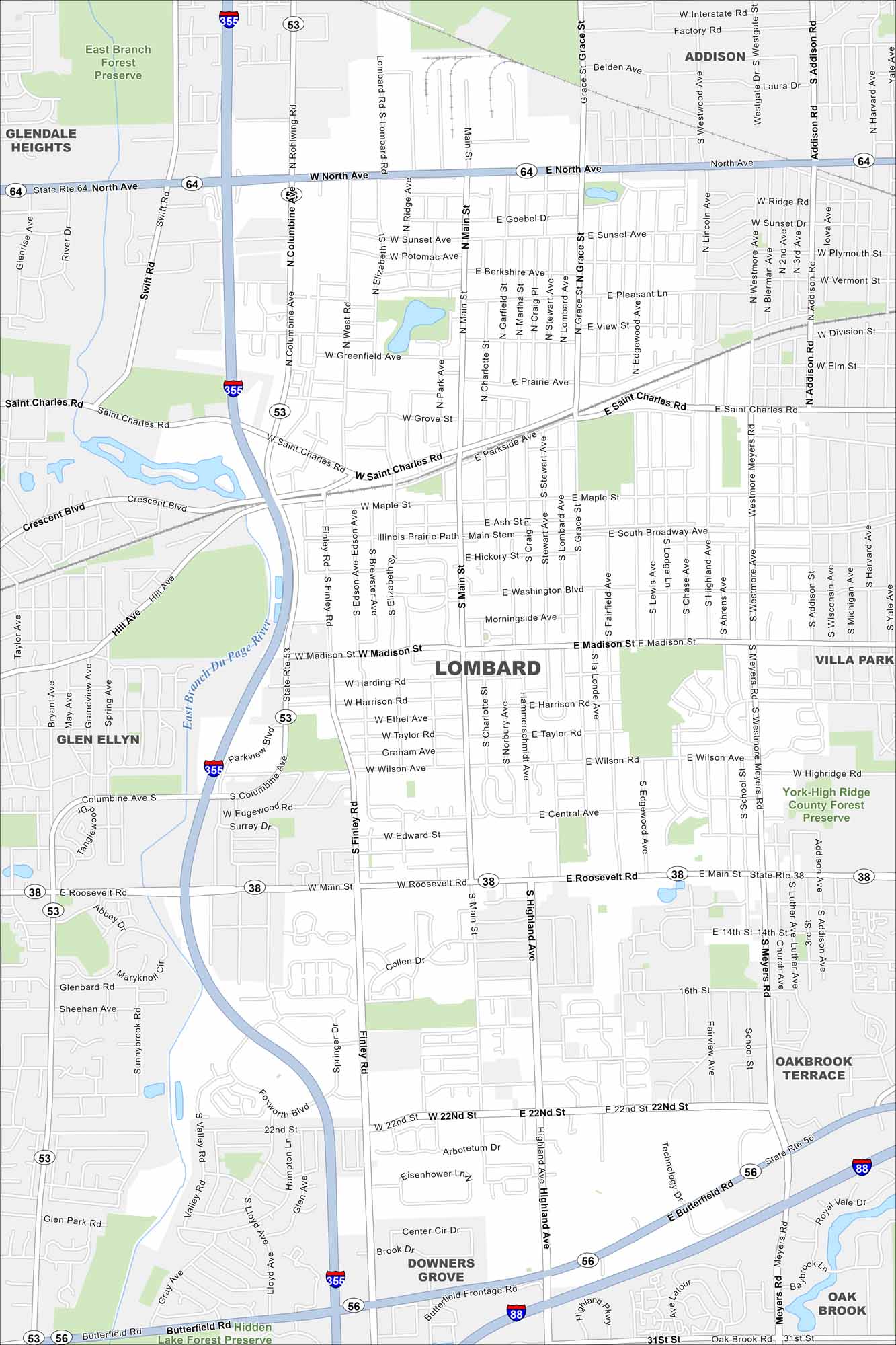
Check out Lombard in suburban DuPage County. Our map shows its grid of neighborhoods west of Chicago. Highways and rail lines keep it tied into the metro area.
Illinois State Maps
Get to know Illinois with our state maps


Map Information
On the Map
Interstates/Highways: I-355, I-88, State Rte 53, State Rte 64, State Rte 38, State Rte 56 Major Roads: North Ave, Roosevelt Rd, St Charles Rd, Main St, Finley Rd, Lombard Ave, Highland Ave, Butterfield Rd, 22nd St, Westmore-Meyers Rd, Addison Rd, Grace St, Villa Ave, Madison St, Wilson Ave, Maple St, Elizabeth St, Columbine Ave, Swift Rd, Glen Ellyn Rd Major Rivers: East Branch Du Page River Parks and Preserves: East Branch Forest Preserve, York-High Ridge County Forest Preserve, Hidden Lake Forest Preserve Nearby Communities: Addison, Villa Park, Oakbrook Terrace, Oak Brook, Downers Grove, Glen Ellyn, Glendale HeightsIllinois City Maps
Explore Chicago and urban regions of Illinois


