Map of Winnetka, Illinois
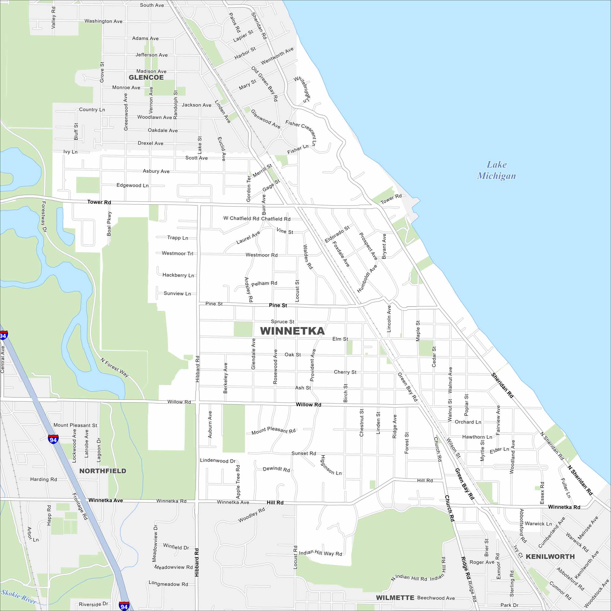
See it here on our map of Winnetka. Village streets are laid out clearly. You’ll also notice its location right along Lake Michigan.
Illinois State Maps
Get to know Illinois with our state maps


Map Information
On the Map
Interstates/Highways: I-94 Major Roads: Willow Rd, Winnetka Ave, Green Bay Rd, Sheridan Rd, Hibbard Rd, Tower Rd, Forestway Dr, Happ Rd, Sunset Rd, Hill Rd, Spruce St, Pine St, Elm St, Oak St, Cherry St, Ash St, Lindenwood Dr, Locust Rd, Church Rd, Ridge Ave Lakes and Reservoirs: Lake Michigan Major Rivers: Skokie River Parks and Preserves: Skokie Lagoons, Crow Island Park, Hubbard Woods Park, Duke Childs Field, Dwyer Park, Nick Corwin Park Nearby Communities: Glencoe, Northfield, Kenilworth, WilmetteIllinois City Maps
Explore Chicago and urban regions of Illinois


